Click to visit the main New York Public Library Homepage
The New York Public Library
Digital Collections
About Digital Collections
Browse
Search only public domain materials
Items
Collections
Divisions
Home
Search
Browse
About
Search only public domain materials
Items
Collections
Divisions
Digital Collections
Using Images
Using Data
Search
Filtered search
Show filters
Hide filters
Show Only Public Domain
topic
History
143
Geography
125
Maps
77
Atlases, British
67
Mathematics
55
More
Less
name
Thornton, Samuel
173
Montanus, Arnoldus, 1625?-1683
117
Ogilby, John, 1600-1676
117
Moll, Herman, -1732
110
Green, John, fl. 1730-1753
56
More
Less
collection
Lawrence H. Slaughter Collection of English maps, charts, globes, books and atlases
511
Atlases, gazetteers, guidebooks and other books
258
Maps of North America
200
Bancker plans
197
A new general collection of voyages and travels: consisting of the most esteemed relations, which have been hitherto published in any language; comprehending everything remarkable in its kind, in Europe, Asia, Africa, and America
55
More
Less
place
America
178
North America
159
Maps
126
West Indies, British
115
New Jersey
68
More
Less
genre
x
Maps
Surveys
223
Nautical charts
176
land surveys
158
Prints
119
More
Less
publisher
Printed by the author, and are to be had at his house
117
Printed for T. Astley
55
Printed by A. Godbid and J. Playford, for R. Scott, bookseller
53
Printed for Timothy Childe at the White Hart at the West-end of St. Paul's Church-yard
44
s.n
43
More
Less
division
Map Division
1046
Manuscripts and Archives Division
206
Rare Book Division
107
Wallach Division: Print Collection
41
Schomburg Jean Blackwell Hutson Research and Reference Division
35
More
Less
type
cartographic
1370
still image
139
text
55
Date Range
to
1,482 results found
Filtering on:
x
Date
: 1669 - 1774
x
Genre
: Maps
Sort by:
Title
Date created
Date digitized
Sequence
Pas kaart van de zee kusten v…
Oud-Groenland, of deszelfs Oo…
A map of Carolina, Florida an…
Pas-kaart vande Rivieren Comm…
Nieuwe kaart van Suriname : v…
Representation la plus nouvel…
A plan of the city of New Yor…
Carte des Isles de L'Amerique…
Carte de L'Isle de Saint-Domi…
Nette Koerswysing van Amsterd…
De nette koers wysing van de …
Le Ruyavme d Abyssinie ou lem…
L"empire du Monomotapa et la …
Isle de Malthe
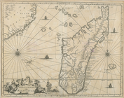
Isle de Madagascar dite de St…
Isles dv Cap Verd
I. Goree
Afrique Ancienne
Afrique Moderne
Partie Septentrionale de L'An…
Congo
Africae Accurata Tabula ex Of…
Nova Aegypti Tabula
Barbaria Biledulgered o: Liby…
Fezzae et Marocchi Regna Afri…
Nigritarum Regio
Gvinea
Aethiopia Inferior vel Exteri…
Regna Congo et Angola
Aethiopia Superior vel Interi…
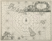
Insvla S. Lavrentii, vulgo Ma…
Insula Promontorii Viridis, H…
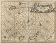
Insula Canariae alias Fortuna…
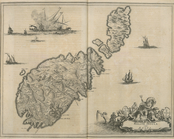
Melite Insula vulgo Masia
Difegno Della Citta Valletta
m
Maps
The Jeannette ; Lost In the I…
A Map or North East and North…
Kaert von Groen-Land, [fold o…
Nova Zembla, p. 101
Plan du port, ville, citadell…
Nova & accuratissima celeberr…
Map and survey of lands of up…
Survey of the Grange of Portm…
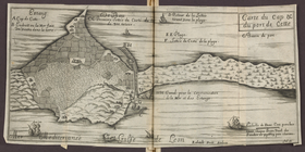
Carte du cap & du port de Cet…
m
H.M.S. Aeolus and H.M.S. Norw…
Pennsylvania and Maryland map
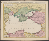
Nouvelle carte de la Crimée &…
A new map of that part of Afr…
A map of the icy sea in which…
1
2
3
4
5
6
Previous
Next
1
2
3
4
5
6
Previous
Next