Click to visit the main New York Public Library Homepage
The New York Public Library
Digital Collections
About Digital Collections
Browse
Search only public domain materials
Items
Collections
Divisions
Home
Search
Browse
About
Search only public domain materials
Items
Collections
Divisions
Digital Collections
Using Images
Using Data
Search
Filtered search
Show filters
Hide filters
Show Only Public Domain
topic
Mathematics
53
Astronomy, 1681
52
Geography
52
Atlases, British
13
Coasts
11
More
Less
name
Flamsteed, John, 1646-1719
52
Godbid, A
52
Hanway, William
52
Moore, Jonas, Sir, 1617-1679
52
Perkins, Peter, -1680
52
More
Less
collection
Lawrence H. Slaughter Collection of English maps, charts, globes, books and atlases
84
Description de l'univers, contenant les differents systêmes di monde, les cartes generales & particulieres de la geographie ancienne & moderne: les plans & les profils des principales villes & des autres lieux plus considerables de la terre; avec les portraits des couverains qui y commandent, leurs blasons, titres & livrées: et les mœurs, religions, gouvernemens & divers havillemens de chaque nation
6
Maps of North America
6
Relation universelle de l'Afrique, ancienne et moderne
5
Description de l'univers ..
4
More
Less
place
Maps
13
Africa
9
New England
6
New Jersey
6
Caribbean Area
5
More
Less
genre
Maps
114
Illustrations
10
Prints
5
Surveys
2
Cadastral maps
1
More
Less
publisher
Printed by A. Godbid and J. Playford, for R. Scott, bookseller
52
Printed for Robert Morden and Thomas Cockeril, at the Atlas in Cornhill, and at the Three Legs in the Poultrey, over against the Stocks-Market
6
Printed by A. Godbid and J. Playford, for John Seller ...,
5
T. Amaulry
5
Chez I.B. Nolin ..
4
More
Less
division
Map Division
92
Schomburg Manuscripts, Archives and Rare Books Division
9
Rare Book Division
7
Wallach Division: Print Collection
4
General Research Division
1
More
Less
type
x
cartographic
still image
3
text
2
Date Range
to
114 results found
Filtering on:
x
Date
: 1680 - 1689
x
Type
: cartographic
Sort by:
Title
Date created
Date digitized
Sequence
Pas kaart van de zee kusten v…
Le Ruyavme d Abyssinie ou lem…
L"empire du Monomotapa et la …
Isle de Malthe
Isle de Madagascar dite de St…
Isles dv Cap Verd
I. Goree
Afrique Ancienne
Afrique Moderne
Partie Septentrionale de L'An…
m
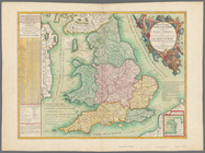
Le royaume d'Angleterre: divi…
m
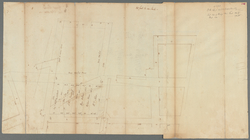
Great Dock - original protrac…
Map of Gotham Division of the…
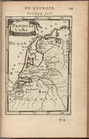
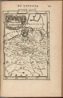
Provinces-Unies, fig. 95, p. …
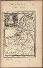
Pays-Bas Catholiques, fig. 97…
Pays-Bas en général, fig. 93,…
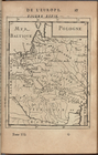
Pologne, vol. 4, fig. 39, p. …
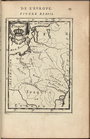
Pologne, vol. 4, fig. 37, p. …
Pologne, vol. 4, fig. 36, p. …
Pas kaart van West Indien : b…
Partie orientale du Canada ou…
Map of West's patent on west …
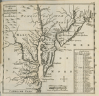
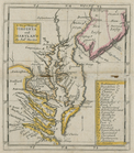
A new map of Virginia and Mar…
A new map of Virginia, Mary-l…
Pas-Kaart vande zee kusten va…
Le Canada, ou Nouvelle France…
L'Amerique septentrionale, ou…
m
Segments of 4 half globe gore…
m
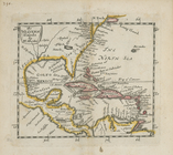
A chart of the West Indias fr…
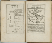
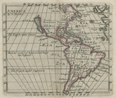
America.
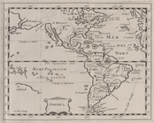
America.
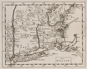
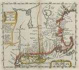
New England.
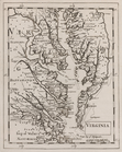
Virginia.
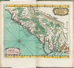
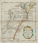
Carolina newly discribed
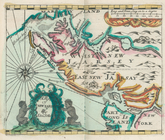
A map of New Iarsey
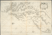
A chart of the sea coasts of …
Nouvelle carte de la Pensylva…
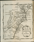
Nouvelle carte de la Caroline
m
A chart of the West Indias fr…
m
North America divided into it…
The Western Ilands
Carolina, Virginia, Mary Land…
New England and New York
A new map of Virginia and Mar…
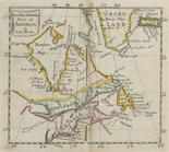
The north west part of America
America
A chart of the sea coasts of …
A chart of the West Indies fr…
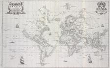
New mapp of the world accordi…
Virginia, Maryland, Pennsilva…