Click to visit the main New York Public Library Homepage
The New York Public Library
Digital Collections
About Digital Collections
Browse
Search only public domain materials
Items
Collections
Divisions
Home
Search
Browse
About
Search only public domain materials
Items
Collections
Divisions
Digital Collections
Using Images
Using Data
Search
Filtered search
Show filters
Hide filters
Show Only Public Domain
topic
Geography
47
Maps
27
Nautical charts
20
Landowners
12
Real property
12
More
Less
name
Thornton, Samuel
173
Moll, Herman, -1732
109
Childe, Timothy
48
Falconer, Robert, active 1700
44
Luyts, Jan, 1655-1721
44
More
Less
collection
Atlases, gazetteers, guidebooks and other books
189
Lawrence H. Slaughter Collection of English maps, charts, globes, books and atlases
158
Maps of North America
48
I. N. Phelps Stokes Collection of American Historical Prints
9
John H. Levine Collection
8
More
Less
place
North America
51
New Jersey
25
Atlantic Ocean
23
America
22
Maps
20
More
Less
genre
x
Maps
Nautical charts
173
Prints
22
Manuscript maps
11
Surveys
11
More
Less
publisher
Printed for Timothy Childe at the White Hart at the West-end of St. Paul's Church-yard
44
... Sold ... by Tho. Bowles, print and map-seller in St. Paul's-Churchyard
32
s.n
12
Printed for Jer. Seller and Char. Price, at the Hermitage in Wapping
6
Printed for Tho. Bowles and John Bowles
6
More
Less
division
Map Division
418
Wallach Division: Print Collection
16
Rare Book Division
12
Schomburg Jean Blackwell Hutson Research and Reference Division
11
Schomburg Manuscripts, Archives and Rare Books Division
5
More
Less
type
cartographic
460
still image
13
text
2
Date Range
to
465 results found
Filtering on:
x
Date
: 1701 - 1740
x
Genre
: Maps
Sort by:
Title
Date created
Date digitized
Sequence
Pas-kaart vande Rivieren Comm…
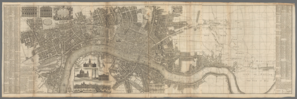
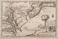
A plan of the city of New Yor…
Carte des Isles de L'Amerique…
Carte de L'Isle de Saint-Domi…
Nette Koerswysing van Amsterd…
De nette koers wysing van de …
m
Maps
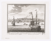
Plan du port, ville, citadell…
Map and survey of lands of up…
Survey of the Grange of Portm…
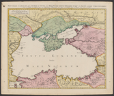
Nouvelle carte de la Crimée &…
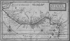
A new map of that part of Afr…
Chertezh zemli Nerchinskiago …
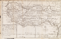
A New and Exact Map of Guinea…
m
London surveyed or a new map …
A map of the Congo regions pu…
m
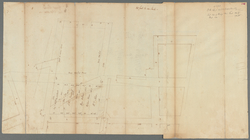
Great Dock - original protrac…
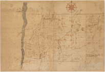
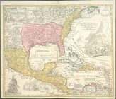
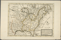
Carolina
Lovisiana by de Rivier Missis…
Florida, called by ye French …
The isle of California, New M…
The Distribution of Indian tr…
Empire des Abissins: comme il…
Carte contenant le royaume du…
m
M. Stacy 1000 a. (survey of M…
m
A plan of 8 acres land survey…
m
Benjn. Field's surveys (of 17…
m
Draught of 8 3/4 acres of lan…
m
Coppy of M. Stacys survey, 13…
m
Mahlon Wright's draft of 86 a…
m
Jos. Kirkbrid's 1250 acre tra…
m
Copy of the return of Joseph …
m
Return of three tract of pine…
m
Isaac Watson resurvey, 1724 (…
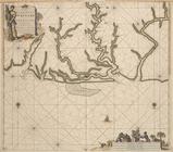
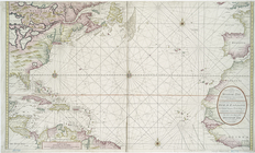
A new & exact map of the coas…
Untitled manuscript map of Gr…
Nieuwe wassende graade zee ka…
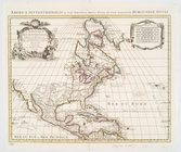
L'Amerique septentrionale : d…
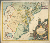
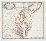
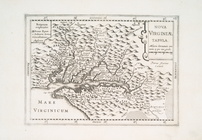
Virginia, Marylandia et Carol…
D'Engelze volkplanting in Vir…
Carte de la Louisiane et du c…
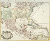
Carte du Mexique et de la Flo…
Regni Mexicani seu Novae Hisp…
Carte de la Nouvelle France: …
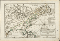
A new map of ye north parts o…
Le Canada, ou Nouvelle France…
A Map of Carolana and of the …
Nieu Amsterdam, een stedeken …
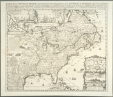
A new map of Virginia, Mary-l…
Nova Virginiae tabula
1
2
Previous
Next
1
2
Previous
Next