Click to visit the main New York Public Library Homepage
The New York Public Library
Digital Collections
About Digital Collections
Browse
Search only public domain materials
Items
Collections
Divisions
Home
Search
Browse
About
Search only public domain materials
Items
Collections
Divisions
Digital Collections
Using Images
Using Data
Search
Filtered search
Show filters
Hide filters
Show Only Public Domain
topic
Description and travel
53
Celestial charts
50
Constellations
50
Stars
50
Antiquities
40
More
Less
name
Norden, Frederik Ludvig, 1708-1742
40
Tuscher, Markus, 1705-1751
40
Flamsteed, John, 1646-1719
30
Bode, Johann Elert, 1747-1826
20
Sarychev, Gavriil Andreevich, 1763-1831
15
More
Less
collection
The antiquities, natural history, ruins and other curiosities of Egypt, Nubia and Thebes. Exemplified in near two hundred drawings taken on the spot
40
Atlas celeste de Flamsteed, publie en 1776
30
Joannis Elerti Bode Uranographia, sive astrorum descriptio viginti tabulis aeneis incisa ex recentissimis et absolutissimis astronomorum observationibus ..
20
Puteshestvie flota kapitana Sarycheva po sieverovostochnoi chasti Sibiri, Ledovitomu moriu i Vostochnomu okeanu, v prodolzhenie osmi liet, pri Geograficheskoi i astronomicheskoi morskoi ekspeditsii, byvshei pod nachalstvom flota kapitana Billingsa s 1785 po 1793 god
15
The history of Japan, giving an account of the ancient and present state and government of that empire [...] Together with a description of the kingdom of Siam: giving an account of the ancient and present state and government of that empire; of its temples, palaces, castles, and other buildings; of its metals, minerals, trees, plants, animals, birds and fishes; of the chronology and succession of the emperors ... of the original descent, religions, customs, and manufactures of the natives, and of their trade and commerce with the Dutch and Chinese. Together with a description of the kingdom of Siam
10
More
Less
place
Egypt
41
Nile River
28
Arctic regions
15
Japan
10
Palestine
4
More
Less
genre
Maps
80
Prints
66
Illustrations
50
pages (components)
15
Plans
2
publisher
Printed for Lockyer Davis
40
Chez Delamarche
30
Apud Autorem
20
Tip. Shnora
15
The translator
10
More
Less
division
x
General Research Division
type
x
cartographic
still image
2
Date Range
to
129 results found
Filtering on:
x
Date
: 1740 - 1806
x
Division
: General Research Division
x
Type
: cartographic
Sort by:
Title
Date created
Date digitized
Sequence
Chart of part of the Coast of…
Plan de la ville Tartare de P…
Det gamle Norge
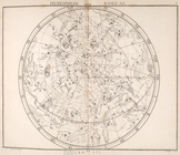
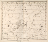
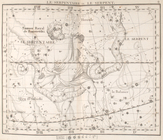
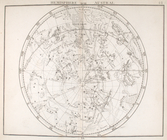
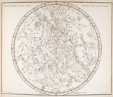
Hemisphere boreal.
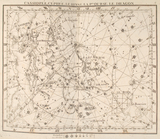
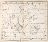
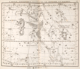
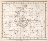
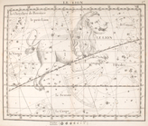
Cassiopée, cépheée, le renne,…
Andromede, persée, le triangl…
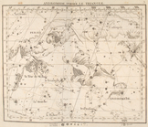
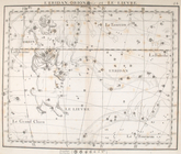
La giraffe, le cocher.
La lynx, le petit lion.
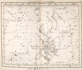
La grande ourse.
Le bouvier, les levriers, la …
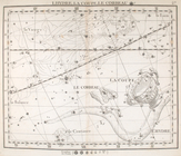
Hercule, la couronne.
Le serpentaire & le serpent.
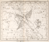
L'aigle, antinoűs, la flêche,…
La lyre, le cygne, le lezard,…
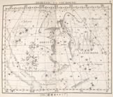
Pegase, le petit cheval, le d…
Le belier.
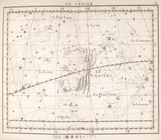
Le taureau.
Les gemeaux.
Le cancer.
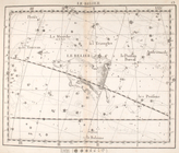
Le lion
La vierge.
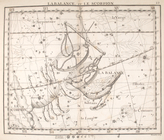
La balance & le scorpion.
Le capricorne & le verseau.
Les poissons.
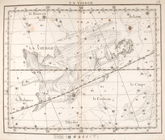
La baleine
L'eridan, orion & le lievre
La licorne, le grand chien.
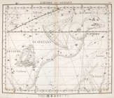
Lhydre le sextant.
Lhydre, la coupe, le corbeau.
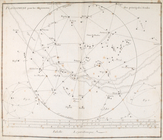
Hemisphere austral.
Hemisphere austral, fuivant l…
Planisphere & figures.
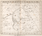
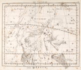
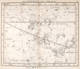
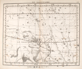
La sagittaire.
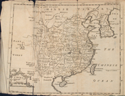
Map of China
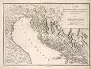
Carte de l'Istrie et de la Da…
Plan General de la Ville et d…
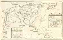
Carte des pays frequentés par…
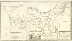
Route des Hebreux pour passer…
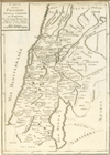
Carte de la terre de Chanaan,…
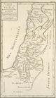
Carte de la Palestine selon l…
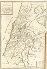
Carte de la Palestine depuis …
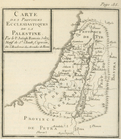
Carte des provinces ecclesias…
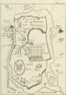
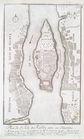
Plan de Jerusalem
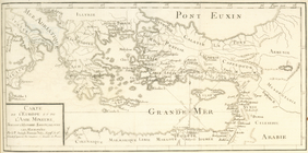
Carte de l'Europe et de l'Asi…
Carte particuliére de la viei…
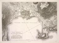
Carte et plan du port neuf d'…
Plan de l'Isle de Rodda, avec…
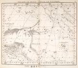
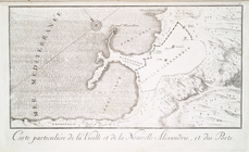
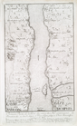
Cours du Nil, et Lieux situés…
Premier Partie de la Carte du…
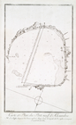
Plan et situation de Pyramide…