Click to visit the main New York Public Library Homepage
The New York Public Library
Digital Collections
About Digital Collections
Browse
Search only public domain materials
Items
Collections
Divisions
Home
Search
Browse
About
Search only public domain materials
Items
Collections
Divisions
Digital Collections
Using Images
Using Data
Search
Filtered search
Show filters
Hide filters
Show Only Public Domain
topic
Real property
6544
Fire insurance
3767
Cities & towns
3559
Administrative and political divisions
878
Railroads
699
More
Less
name
Sanborn Map Company
3558
Beers, F. W. (Frederick W.)
588
E. Robinson Co
345
Perris, William
308
G.W. Bromley & Co
306
More
Less
collection
Atlases of New York City
5132
Maps of North America
3137
Atlases of the United States
2597
Maps of New York City and State
1503
Bancker plans
889
More
Less
place
New York (State)
7338
New York
1453
New York (N.Y.)
896
Manhattan (New York, N.Y.)
830
United States
737
More
Less
genre
Maps
15114
Atlases
2541
Surveys
953
land surveys
796
Cadastral maps
532
More
Less
publisher
Sanborn Map Company
3558
publisher not identified
438
E. Robinson Co
297
G.W. Bromley & Co
226
F. W. Beers & Co
148
More
Less
division
Map Division
13340
Manuscripts and Archives Division
937
General Research Division
397
Rare Book Division
192
Schomburg Jean Blackwell Hutson Research and Reference Division
77
More
Less
type
x
cartographic
text
382
still image
214
Date Range
to
15,352 results found
Filtering on:
x
Date
: 1758 - 1899
x
Type
: cartographic
Sort by:
Title
Date created
Date digitized
Sequence
Results 501 - 550
Portion of the Military depar…
A preliminary geological map …
Map showing the distribution …
Map of the extinct Lake Passa…
Water shed of the Passaic Riv…
Map of part of Jersey City, …
Colton's Georgetown and the c…
1892, Harrison's map of Jerse…
Harrison's map of Jersey City…
m
Map of property at Fairmount…
A map of the town of New-ark …
Rand, McNally & Co.'s New Jer…
Colton's excursion map of Nor…
Map of the boundary line betw…
Progress map of the state of …
Topographical map of that por…
Map of the railroads of Conne…
Phelps's national map of the …
Map of the western states to …
m
A new map of the western rive…
To accompany Willard's histor…
Planta topografica della citt…
Rouine d'un Tempio d'Iside pr…
Pianta della città del Cairo.
Pianta topografica di alcune …
Altra veduta di Carnac; Piant…
Pianta del tempio di Luxor.
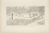
Piano generale di Tebe.
Pianta del tempio di File.
m
United States
Plan of Public Garden: showin…
Back Bay and Parker Hill park…
Plan of burnt district (by fi…
Plan of real estate at Harris…
Map of the water region: adja…
Plan of main ship channel in …
No. III, changes in the bed o…
Sketch of the action on the h…
Sketch of the Battle of Bunke…
Skeleton map of the overland …
Map showing condition and pro…
Plan showing the redoubt, bre…
Map of Boston for 1878: Publi…
Plan of Charles River and War…
Plan of land on West Chester …
Map of Boston and the country…
Map of the country about Bost…
Map of New England, with adja…
Map showing the New York and …
Map of Massachusetts, Vermont…
1
2
3
4
5
6
7
8
9
10
…
61
62
Previous
Next
1
2
3
4
5
6
7
8
9
10
…
61
62
Previous
Next