Click to visit the main New York Public Library Homepage
The New York Public Library
Digital Collections
About Digital Collections
Browse
Search only public domain materials
Items
Collections
Divisions
Home
Search
Browse
About
Search only public domain materials
Items
Collections
Divisions
Digital Collections
Using Images
Using Data
Search
Filtered search
Show filters
Hide filters
Show Only Public Domain
topic
History
86
Description and travel
56
Nautical charts
49
Antiquities
40
Maps
34
More
Less
name
Norden, Frederik Ludvig, 1708-1742
40
Tuscher, Markus, 1705-1751
40
Faden, William, 1749-1836
38
Kitchin, Thomas, 1718-1784
26
Lodge, John, -1796
23
More
Less
collection
Bancker plans
444
Maps of North America
184
Lawrence H. Slaughter Collection of English maps, charts, globes, books and atlases
126
Maps of New York City and State
48
The antiquities, natural history, ruins and other curiosities of Egypt, Nubia and Thebes. Exemplified in near two hundred drawings taken on the spot
40
More
Less
place
North America
83
United States
65
New York (N.Y.)
55
New Jersey
49
Maps
48
More
Less
genre
Maps
954
Surveys
448
land surveys
370
Documents
73
Prints
71
More
Less
publisher
Printed for Lockyer Davis
40
s.n
23
Imprimé à l'Université Imperiale de Moscou
22
publisher not identified
21
Presso Antonio Zatta
12
More
Less
division
Manuscripts and Archives Division
452
Map Division
414
General Research Division
61
Rare Book Division
30
Wallach Division: Print Collection
27
More
Less
type
x
cartographic
text
84
still image
10
Date Range
to
1,002 results found
Filtering on:
x
Date
: 1759 - 1784
x
Type
: cartographic
Sort by:
Title
Date created
Date digitized
Sequence
Results 501 - 550
m
East River
m
North River
m
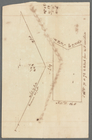
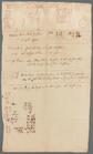
Mandeville's near the Wey Land
m
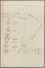
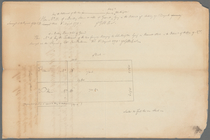
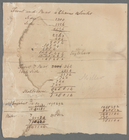
Survey of lot
m
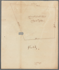
Tract of land
m
Penet
m
Tract bordered by Maerschalk …
m
Survey east of Lord Dunmore's…
m
Tract of land
m
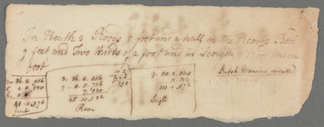
Settlement of dimensions
m
Coenties Slip
m
Roosevelt Street
m
Piece of ground near the ston…
m
Cleared ground - Colonel De L…
m
Colonel De Lancey - near ston…
m
Ground on Golden Hill owned b…
m
Samuel Pell's lots
m
Harlem Line description
m
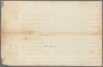
John Devoor's farm made agree…
m
I. Low's purchase
m
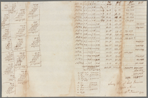
Description of Anne Depeyster…
m
Englehart's given by Mr. Mill…
A plan of the attack of Fort …
Sketch of the battle of Hobki…
m
An accurate map of North and …
A new and accurate map of Nor…
Carte réduite des côtes et de…
East Florida : from surveys m…
Plan of the action at Huberto…
Position of the detachment un…
A map of such parts of Georgi…
Map of the Province of West F…
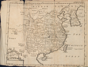
Map of China
m
A map of South Carolina and a…
m
A map of South Carolina : wit…
A plan of the attack of Fort …
Louisiana, as formerly claime…
A plan of Bahia del Espiritu …
Plan of the siege of Savannah
Plan of the town and harbour …
Plan de la Baye de Pensacola …
m
A new map of the River Missis…
Carte d'une partie des côtes …
m
A chart of the harbour of Rho…
A Plan of the town of Newport…
A plan of the town of Newport…
A new and accurate map of the…
A map of the new governments …
A new and accurate map of eas…
A new and accurate map of eas…
1
2
3
4
5
Previous
Next
1
2
3
4
5
Previous
Next