Click to visit the main New York Public Library Homepage
The New York Public Library
Digital Collections
About Digital Collections
Browse
Search only public domain materials
Items
Collections
Divisions
Home
Search
Browse
About
Search only public domain materials
Items
Collections
Divisions
Digital Collections
Using Images
Using Data
Search
Filtered search
Show filters
Hide filters
Show Only Public Domain
topic
Real property
1967
Parks
1242
Streets
614
Office buildings
318
Dwellings
298
More
Less
name
Federal Art Project (New York, N.Y.)
1908
Abbott, Berenice, 1898-1991
1907
G.W. Bromley & Co
1672
E. & H.T. Anthony (Firm)
495
Bromley, George Washington
405
More
Less
collection
Robert N. Dennis collection of stereoscopic views
2353
Atlases of New York City
1954
Changing New York
1866
Maps of New York City and State
335
Collection of broadside real estate maps announcing auctions of lots in early 19th century New York City
67
More
Less
place
x
Manhattan (New York, N.Y.)
New York (State)
6418
New York
5864
New York (N.Y.)
4980
Central Park (New York, N.Y.)
1022
More
Less
genre
Photographs
4281
Stereographs
2353
Maps
2315
Cadastral maps
83
Index maps
49
More
Less
publisher
G.W. Bromley & Co
1624
Perris & Browne
124
William Perris
105
G.W. Bromley
49
E. & H.T. Anthony (Firm)
33
More
Less
division
Wallach Division: Photography Collection
4230
Map Division
2232
Milstein Division
57
Wallach Division: Print Collection
19
Wallach Division: Picture Collection
4
More
Less
type
still image
4310
cartographic
2362
text
83
Date Range
to
6,682 results found
Filtering on:
x
Date
: 1764 - 1973
x
Place
: Manhattan (New York, N.Y.)
x
Rights
: Public Domain
Sort by:
Title
Date created
Date digitized
Sequence
m
Maps of property in the city …
m
Union Square, 14th Street and…
m
The Elevated at Eighth Avenue…
The Evening Mail's complete m…
Tracts and farms with street …
Carl Schurz Park
Park between 35th and 36th St…
Hagstrom's map of lower New Y…
m
Riverside Park
m
Map of Manhattan showing the …
Block sketch 1679, New York C…
m
Hammond's complete map of New…
Colonial Park
Rand McNally Map of Brooklyn
City Hall Park
m
Tentative height districts, M…
m
Tentative use districts, Manh…
Freight terminal map of New Y…
Center of New York, first cit…
New-York City, County, and vi…
Sketch map of the city of New…
New map of the great metropol…
Map of the Harlem River and S…
Hammond's new guide map of Ma…
Block line map of the heavy v…
m
Manhattan borough and part of…
m
Rand-McNally standard map of …
m
Stone and Williams Streets
m
Wall Street, showing East Riv…
m
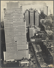
Daily News Building, 42nd Str…
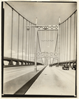
Manhattan Bridge, From Bowery…
m
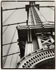
Triborough Bridge, (Cables)
m
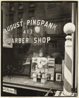
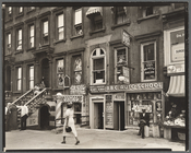
Pingpank Barber Shop, 413 Ble…
m
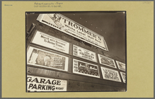
Advertisements: 1937, East Ho…
m
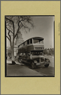
Fifth Avenue Bus, Washington …
m
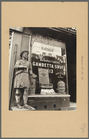
Snuff Shop, 113 Division stre…
m
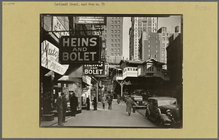
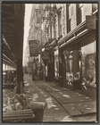
Radio Row, Cortlandt Street
m
Vista from West Street, 115-1…
m
Sumner Healy Antique Shop, 94…
m
Waterfront, From roof of Irvi…
m
Manhattan Skyline: I, South S…
m
Financial District Rooftops: …
m
Pine Street: U. S. Treasury i…
m
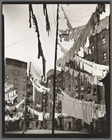
Harlem Street: II, 422-424 Le…
m
Allen Street, #55-57
m
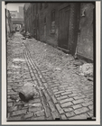
Charles Lane, Between West an…
m
Shelter on the water front
m
Court of first model tenement…
m
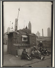
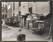
Unemployed and huts, West Hou…
m
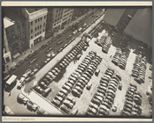
Rockefeller Center Parking Sp…
1
2
3
4
5
6
7
8
9
10
…
26
27
Previous
Next
1
2
3
4
5
6
7
8
9
10
…
26
27
Previous
Next