Click to visit the main New York Public Library Homepage
The New York Public Library
Digital Collections
About Digital Collections
Browse
Search only public domain materials
Items
Collections
Divisions
Home
Search
Browse
About
Search only public domain materials
Items
Collections
Divisions
Digital Collections
Using Images
Using Data
Search
Filtered search
Show filters
Hide filters
Show Only Public Domain
topic
Road maps
53
History
30
Geography
25
Colonies
9
Campaigns
4
More
Less
name
Colles, Christopher, 1738-1816
53
Tiebout, Cornelius, 1777-1832
53
Morse, Jedidiah, 1761-1826
26
Stockdale, John, 1749?-1814
25
American Revolution (1775-1783)
12
More
Less
collection
Lawrence H. Slaughter Collection of English maps, charts, globes, books and atlases
100
Maps of North America
39
Maps of New York City and State
4
I. N. Phelps Stokes Collection of American Historical Prints
3
John H. Levine Collection
3
More
Less
place
x
United States
Middle Atlantic States
55
North America
20
Great Britain
11
America
10
More
Less
genre
x
Maps
Prints
3
Early works to 1800
2
Nautical charts
2
Early maps
1
More
Less
publisher
Printed for J. Stockdale
25
Tobias Conrad Lotter?
5
publisher not identified
5
s.n
5
Buisson,
3
More
Less
division
Map Division
146
Wallach Division: Print Collection
3
Rare Book Division
2
Manuscripts and Archives Division
1
Spencer Collection
1
type
cartographic
153
text
1
Date Range
to
153 results found
Filtering on:
x
Date
: 1766 - 1794
x
Genre
: Maps
x
Place
: United States
Sort by:
Title
Date created
Date digitized
Sequence
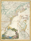
Map of Virginia, Maryland and…
A map of New Jersey : from th…
Pennsylvania - Paoli, Chester…
A new map of North America fr…
A plan of Captain Carvers tra…
Attack of the rebels upon For…
Plan of the position which th…
Grundriss des nördlichen Thei…
Plan von den Operationen der …
Plan of Amelia Island in East…
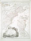
An accurate map of North and …
Plan of the siege of York Tow…
South-Carolina and parts adja…
A plan of the attack of Fort …
Sketch of the battle of Hobki…
m
An accurate map of North and …
Plan of the battle fought nea…
Plan of the action at Huberto…
Position of the detachment un…
Plan of the siege of Savannah
Carte d'une partie des côtes …
m
A chart of the harbour of Rho…
Plan of the action of Huberto…
An accurate map of Rhode Isla…
Boston and the adjacent count…
m
Piscataqua Harbour, Portsmout…
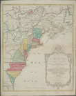
A general map of the southern…
Map of Charleston Neck, South…
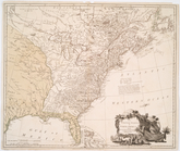
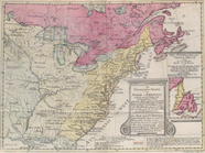
The United States of North Am…
Carte nouvelle de l'Amerique …
Map of the United States in N…
Carte du theatre de la guerre…
The country twenty five miles…
Carte du theatre de la guerre…
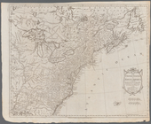
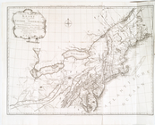
A new and correct map of Nort…
Die vereinigten Staaten von N…
Nieuwe en nauwkeurige kaart v…
Carte réduite du Nord des Eta…
Carte réduite du Sud des État…
Carte d'une partie de l'Améri…
Côte de York-town à Boston : …
Plan d'York en Virginie, avec…
Ètats-Unis de l'Amérique sept…
Carte nouvelle de l'Amerique …
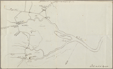
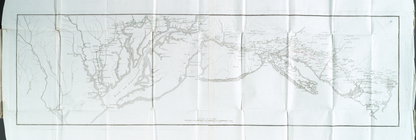
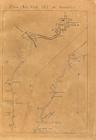
From New York (1) to Stratfor…
From New York (2) to Stratfor…
From New York (3) to Stratfor…
From New York (4) to Stratfor…
From New York (5) to Stratfor…
From New York (6) to Stratfor…