Click to visit the main New York Public Library Homepage
The New York Public Library
Digital Collections
About Digital Collections
Browse
Search only public domain materials
Items
Collections
Divisions
Home
Search
Browse
About
Search only public domain materials
Items
Collections
Divisions
Digital Collections
Using Images
Using Data
Search
Filtered search
Show filters
Hide filters
Show Only Public Domain
topic
Real property
753
Landowners
336
Administrative and political divisions
310
History
303
Nautical charts
292
More
Less
name
Perris, William
308
United States Coast Survey
245
Bache, A. D. (Alexander Dallas), 1806-1867
203
Burr, David H., 1803-1875
195
Perris & Browne
141
More
Less
collection
Maps of North America
1558
Bancker plans
871
Maps of New York City and State
759
Lawrence H. Slaughter Collection of English maps, charts, globes, books and atlases
539
Atlases of New York City
390
More
Less
place
New York (State)
1104
United States
561
New York
498
New York (N.Y.)
460
Manhattan (New York, N.Y.)
403
More
Less
genre
Maps
5341
Surveys
880
land surveys
785
Prints
300
Cadastral maps
265
More
Less
publisher
publisher not identified
255
William Perris
142
Perris & Browne
124
U.S. Coast Survey
123
Chapman and Hall
109
More
Less
division
Map Division
3760
Manuscripts and Archives Division
898
General Research Division
269
Rare Book Division
143
George Arents Collection
53
More
Less
type
x
cartographic
text
274
still image
131
Date Range
to
5,479 results found
Filtering on:
x
Date
: 1770 - 1865
x
Type
: cartographic
Sort by:
Title
Date created
Date digitized
Sequence
Results 1501 - 1550
m
Estate of the late Jacobus Va…
m
Moore Street
m
Maiden Lane and Crown Street
m
Kings Bridge Road
m
Kip's Bay
m
Horn's Hook
m
Ephraim Hart's lot in Greenwi…
m
Courses between Ridgener's Me…
m
Four lots of ground near the …
m
Vacant lot and Romine's land …
m
Corlears Hook and surrounds
m
Bridge, Pearl, Front, and Wat…
m
Beekman Street from William t…
m
General plan of Captain De La…
m
circa 1780-1785
m
Bowery Lane and King's Bridge…
m
Isaac DePeyster's lot in Bowe…
m
N. De Peyster's four lots of …
m
Plot of farm bounded by N. Ri…
m
1800 October 29
m
Greenwich
m
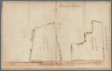
State Prison lot on Hudson Ri…
m
Hammond and Amos at Greenwich
m
Lot surveyed for General De L…
m
Greenwich - Foxcraft
m
Road through Mr. Robertson's …
m
Yellis Mandeville homestead a…
m
Courtland and Greenwich Stree…
m
Mrs. Foxcraft's Rose Hill at …
m
Samuel Franklin's land at Gre…
m
James Seton and Crugar in Gre…
m
Two lots for Elias Burger
m
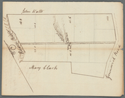
Map of T. B. Clark's land
m
Augustus Van Courtland and Do…
m
Greenwich Street
m
Ephraim Hart's house in Green…
m
Annos's ground, Greenwich and…
m
Greenwich, Hudson, Jay, Haris…
m
F. Rhynlander's ground Greenw…
m
Lots on Greenwich Street
m
Greenwich Street to Hudson Ri…
m
Greenwich Street
m
Barclay and Greenwich Streets
m
Part of the college ground
m
Duane, Jay, Reade, Greenwich,…
m
Abraham Willson's lots at Gre…
m
Water and ground belonging to…
m
Mr. Hugget's land
m
College ground in the river
m
Eight lots on Greenwich Street
1
2
…
4
5
6
7
8
9
10
11
…
21
22
Previous
Next
1
2
…
4
5
6
7
8
9
10
11
…
21
22
Previous
Next