Click to visit the main New York Public Library Homepage
The New York Public Library
Digital Collections
About Digital Collections
Browse
Search only public domain materials
Items
Collections
Divisions
Home
Search
Browse
About
Search only public domain materials
Items
Collections
Divisions
Digital Collections
Using Images
Using Data
Search
Filtered search
Show filters
Hide filters
Show Only Public Domain
topic
History
16
Description and travel
13
Thailand
10
Administrative and political divisions
6
Maps
5
More
Less
name
Sayer, Robert, 1725-1794
11
Kaempfer, Engelbert, 1651-1716
10
Scheuchzer, John Gaspar, 1702-1729
10
Dury, Andrew
7
Montrésor, John, 1736-1799
7
More
Less
collection
Bancker plans
111
Maps of North America
23
Lawrence H. Slaughter Collection of English maps, charts, globes, books and atlases
15
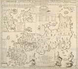
The history of Japan, giving an account of the ancient and present state and government of that empire [...] Together with a description of the kingdom of Siam: giving an account of the ancient and present state and government of that empire; of its temples, palaces, castles, and other buildings; of its metals, minerals, trees, plants, animals, birds and fishes; of the chronology and succession of the emperors ... of the original descent, religions, customs, and manufactures of the natives, and of their trade and commerce with the Dutch and Chinese. Together with a description of the kingdom of Siam
10
I. N. Phelps Stokes Collection of American Historical Prints
5
More
Less
place
North America
11
Japan
10
America
9
Early works to 1800
9
Maps
9
More
Less
genre
Maps
173
Surveys
111
land surveys
98
Documents
13
Illustrations
10
More
Less
publisher
The translator
10
publisher not identified
6
A. Dury ..
4
s.n
3
Printed for Robt. Sayer at No. 53 in Fleet Street, & Thos. Jefferys at the corner of St. Martins Lane, Charing Cross,
2
More
Less
division
Manuscripts and Archives Division
111
Map Division
47
General Research Division
12
Wallach Division: Print Collection
6
Schomburg Jean Blackwell Hutson Research and Reference Division
2
More
Less
type
x
cartographic
text
14
still image
1
Date Range
to
179 results found
Filtering on:
x
Date
: 1771 - 1775
x
Type
: cartographic
Sort by:
Title
Date created
Date digitized
Sequence
m
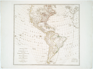
A chart of North and South Am…
A chart of the Atlantic Ocean…
A General map of America divi…
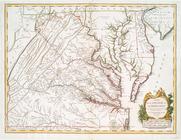
A map of Pennsylvania exhibit…
m
A map of South Carolina : wit…
A map of the British and Fren…
m
A map of the British and Fren…
A map of the British colonies…
A map of the British dominion…
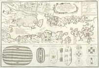
A map of the city of Nagasaki…
A map of the course of the ri…
A map of the Empire of Japan,…
m
A map of the most inhabited p…
m
A map of the most inhabited p…
A map of the most inhabited p…
m
A map of the most inhabited p…
A map of the most inhabited p…
A map of the Province of New …
A map of the Province of New …
A map of the Province of New …
A map of the Province of New …
A map of the Province of New …
A map of the whole continent …
A map of the world, with the …
A new and accurate map of the…
A new and accurate plan of th…
A particular map of the autho…
A particular map of the road …
A particular map of the road …
A particular map of the voyag…
A plan of the battle, on Bunk…
A plan of the city of New-Yor…
A plan of the city of New-Yor…
A plan of the town and harbou…
A sketch of the Cherakee boun…
m
Adolph Waldron's lot in the s…
m
Alderman Dyckman's farm
m
Alderman Dyckman's farm accor…
America Septentrionalis
America Septentrionalis conci…
America Septentrionalis conci…
An accurate map of North Amer…
An accurate map of North and …
m
An accurate map of North and …
m
Anthony Rutger's Brewery
m
Anthony Rutgers's upland and …
m
Back of City Hall
m
Bayard Street
m
Bedlow's Island
Boston and the adjacent count…