Click to visit the main New York Public Library Homepage
The New York Public Library
Digital Collections
About Digital Collections
Browse
Search only public domain materials
Items
Collections
Divisions
Home
Search
Browse
About
Search only public domain materials
Items
Collections
Divisions
Digital Collections
Using Images
Using Data
Search
Filtered search
Show filters
Hide filters
Show Only Public Domain
topic
Colonies
2
Colonial forces
1
Commerce
1
History
1
Indian traders
1
More
Less
name
Jefferys & Faden (London, England)
2
Kitchin, Thomas, 1718-1784
2
Mitchell, John, 1711-1768
2
Bell, Peter (Geographer)
1
Conder, Thomas, 1746 or 1747-1831
1
More
Less
collection
Maps of North America
4
Lawrence H. Slaughter Collection of English maps, charts, globes, books and atlases
2
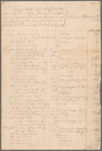
Fort Niagara statement of account with Edward Pollard
1
place
x
North America
America
5
Great Britain
4
Colonies
2
Early works to 1800
2
More
Less
genre
Maps
6
Accounts
1
publisher
Printed for W. Strahan, and T. Becket and Co
2
Printed for Jefferys and Faden, geographers to the King at the corner of St. Martins Lane, Charin Cross
1
Printed for Jefferys and Faden, geographers to the King, at the corner of St. Martin's Lane, Charing Cross
1
Printed for Robt. Sayer, No. 53 in Fleet Street ...,
1
s.n
1
division
Map Division
5
Manuscripts and Archives Division
1
type
cartographic
5
text
2
Date Range
to
7 results found
Filtering on:
x
Date
: 1773 - 1774
x
Place
: North America
Sort by:
Title
Date created
Date digitized
Sequence
m
Fort Niagara statement of acc…
A map of the British dominion…
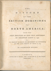
The history of the British do…
A map of the British and Fren…
m
A map of the British and Fren…
North America, agreeable to t…
North America, as divided amo…