Click to visit the main New York Public Library Homepage
The New York Public Library
Digital Collections
About Digital Collections
Browse
Search only public domain materials
Items
Collections
Divisions
Home
Search
Browse
About
Search only public domain materials
Items
Collections
Divisions
Digital Collections
Using Images
Using Data
Search
Filtered search
Show filters
Hide filters
Show Only Public Domain
topic
History
35
Nautical charts
16
Long Island, Battle of, New York, N.Y., 1776
12
Colonies
9
Maps
5
More
Less
name
Faden, William, 1749-1836
21
Lotter, Matthäus Albrecht, 1741-1810
12
Robert Sayer and John Bennett (Firm)
12
Kitchin, Thomas, 1718-1784
8
Lotter, Tobias Conrad, 1717-1777
8
More
Less
collection
Lawrence H. Slaughter Collection of English maps, charts, globes, books and atlases
33
Maps of North America
31
Maps of New York City and State
25
I. N. Phelps Stokes Collection of American Historical Prints
7
Cartographic materials from the Emmet collection of manuscripts etc. relating to American history
3
More
Less
place
New York (N.Y.)
28
New Jersey
21
United States
19
New York (State)
17
North America
16
More
Less
genre
Maps
106
Prints
9
Early works to 1800
4
Early maps
2
Manuscript maps
2
More
Less
publisher
Tobias Conrad Lotter?
5
s.n.,
4
Jefferys & Faden
3
M. A. Lotter
3
Printed for Robt. Sayer & John Bennett, sea chart & map-sellers ..
3
More
Less
division
Map Division
95
Wallach Division: Print Collection
9
Manuscripts and Archives Division
2
Schomburg Manuscripts, Archives and Rare Books Division
1
type
x
cartographic
text
4
Date Range
to
107 results found
Filtering on:
x
Date
: 1776 - 1777
x
Type
: cartographic
Sort by:
Title
Date created
Date digitized
Sequence
Pennsylvania - Paoli, Chester…
Grundriss des nördlichen Thei…
Plan von den Operationen der …
A plan of New York Island, pa…
The harbour of Charles Town i…
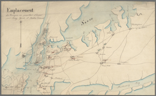
Emplacement des troupes en qu…
Plan der Attaque, welche Sr. …
A plan of Charles Town, the c…
m
Corlear's Hook - soil and wat…
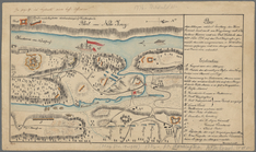
A plan of the attack of Fort …
A plan of the attack of Fort …
m
A chart of the harbour of Rho…
A Plan of the town of Newport…
A plan of the town of Newport…
A new and accurate map of eas…
Coastal chart of the Massachu…
A view of the rivers Kenebec …
An accurate map of the countr…
Part of North America, contai…
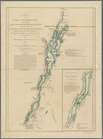
A survey of Lake Champlain: i…
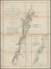
A survey of Lake Champlain: i…
A general map of the southern…
Carte de la Virginie et du Ma…
Carte nouvelle de l'Amerique …
The country twenty five miles…
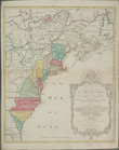
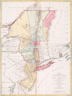
The provinces of New York, an…
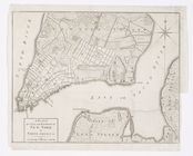
A Plan of the city and enviro…
A map of the provinces of New…
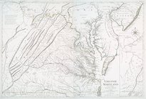
Virginie, Maryland : en 2 feu…
A chart of Delaware Bay and R…
A chart of Delaware Bay and R…
Baye de la Delaware avec les …
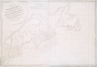
The coast of Nova Scotia, New…
A new map of the whole contin…
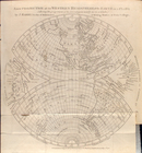
A new projection of the Weste…
A Map of the country round Ph…
Carte nouvelle de l'Amerique …
A plan of New York Island, wi…
m
The British colonies in North…
Carte des possessions anglois…
Sketch of the country illustr…
The Theatre of war in North A…
Theatre de la guerre en Améri…
Cours de la rivière d'Hudson …
m
The provinces of New York, an…
Chart of the entrance of Huds…
A chart of Delaware Bay and R…
Plan of the city of New York …
Carte nouvelle de l'Amerique …
Carte nouvelle de l'Amerique …