Click to visit the main New York Public Library Homepage
The New York Public Library
Digital Collections
About Digital Collections
Browse
Search only public domain materials
Items
Collections
Divisions
Home
Search
Browse
About
Search only public domain materials
Items
Collections
Divisions
Digital Collections
Using Images
Using Data
Search
Filtered search
Show filters
Hide filters
Show Only Public Domain
topic
History
27
Nautical charts
18
Administrative and political divisions
6
Fortification
6
Coasts
5
More
Less
name
Lodge, John, -1796
20
Bew, John, -1793
15
Faden, William, 1749-1836
13
Zatta, Antonio, fl. 1757-1797
12
Hinton, John, -1781
11
More
Less
collection
Bancker plans
207
Maps of North America
66
Lawrence H. Slaughter Collection of English maps, charts, globes, books and atlases
57
Maps of New York City and State
13
Cartographic materials from the Emmet collection of manuscripts etc. relating to American history
6
More
Less
place
North America
24
New York (State)
22
New Jersey
18
United States
18
Maps
17
More
Less
genre
x
Maps
Surveys
207
land surveys
178
Documents
29
Early maps
5
More
Less
publisher
Presso Antonio Zatta
12
J. Hinton
8
J.F.W. Des Barres
6
publisher not identified
6
s.n
6
More
Less
division
Manuscripts and Archives Division
211
Map Division
149
Wallach Division: Print Collection
4
Rare Book Division
2
Wallach Division: Art & Architecture Collection
2
More
Less
type
cartographic
369
text
32
still image
5
Date Range
to
370 results found
Filtering on:
x
Date
: 1778 - 1782
x
Genre
: Maps
Sort by:
Title
Date created
Date digitized
Sequence
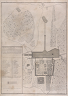
Plan de la maison de plaisanc…
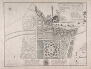
Solitude jardin chinois anglo…
m
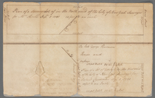
Stone and Marketfield Street
m
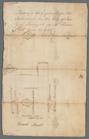
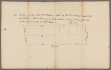
Ground of John Pamiter in Bea…
m
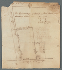
Mount Pitt
m
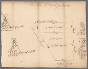
Sketch of Mount Pitt
m
First sketch of James De Lanc…
m
Brooklyn Ferry
m
David Provoost's lots in the …
m
Sheerbrook's lot corner of Br…
m
Delancey's estate at Whitehall
m
Ground on Golden Hill owned b…
m
Heirs of Mr. Brassee's house …
m
The late John Hopper's farm a…
m
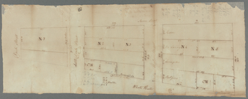
Hopper Farm, showing divisions
m
Plot of farm bounded by N. Ri…
m
Benjamin Booth's lot north si…
A map of the province of Mass…
m
Captain De Lancey's ground
To His Excellency Genl. Washi…
To his excellency Genl Washin…
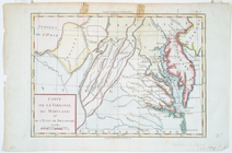
Carte de la Virginie, du Mary…
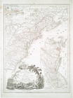
Carte du theatre de la guerre…
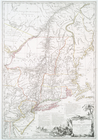
Carte du théatre de la guerre…
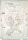
Carte generale de la terre : …
Carte de l'Amérique septentri…
Carte de la Louisiane et du c…
Carte generale des treize Eta…
Carte de la Louisiane et du c…
m
Plano.: de la Ysla de Sn. Jua…
m
Piece of Church ground leased…
Chart and plan of the harbour…
Chart and plan of the harbour…
m
Lot in Princess Street
m
Carr's ground in Beaver Street
m
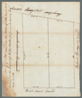
North side of Beaver Street
m
Plan of lots number one to fo…
m
Lot in Crown Street or Maiden…
m
Golden Hill and Van Clyff's S…
m
Ground between William and Jo…
m
Broadway, Anne and Fair Stree…
m
Hester Pell's lot in Broad St…
m
Dr. Charleton's ground in Lum…
m
Norfolk, Suffolk, Division, a…
m
Lot in Broad Street
m
Frankfort and Kip Streets
m
Kip Street
m
Meyer's lot in Fair Street
m
Mr. Milliner's lots between d…
m
South west side of Little Que…
1
2
Previous
Next
1
2
Previous
Next