Click to visit the main New York Public Library Homepage
The New York Public Library
Digital Collections
About Digital Collections
Browse
Search only public domain materials
Items
Collections
Divisions
Home
Search
Browse
About
Search only public domain materials
Items
Collections
Divisions
Digital Collections
Using Images
Using Data
Search
Filtered search
Show filters
Hide filters
Show Only Public Domain
collection
x
Bancker plans
genre
Maps
29
Surveys
29
land surveys
27
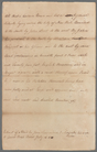
Documents
2
division
Manuscripts and Archives Division
29
type
x
cartographic
text
2
Date Range
to
29 results found
Filtering on:
x
Date
: 1782 - 1783
x
Collection
: 0a16ae00-c473-0134-a669-00505686d14e
x
Type
: cartographic
Sort by:
Title
Date created
Date digitized
Sequence
m
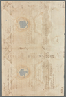
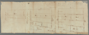
Mrs. Wever's lots in Queen St…
m
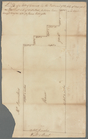
Nassau Street, John Street, a…
m
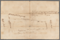
Lands in the Jerseys
m
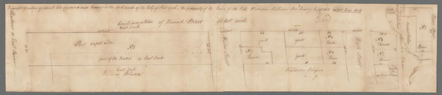
North side of Hanover Square
m
Andrew Elliot's seat in Bower…
m
Tract of land at Morrisania
m
Cherry Street from George to …
m
Two lots in William and Littl…
m
Mr. De Peyster's lot in Broad…
m
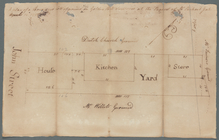
Pine Street drain
m
Lot and house in Wall Street …
m
Lot and two houses between Do…
m
William Miller's whole real e…
m
Stone and Marketfield Street
m
Ground of John Pamiter in Bea…
m
Mount Pitt
m
Sketch of Mount Pitt
m
First sketch of James De Lanc…
m
Brooklyn Ferry
m
David Provoost's lots in the …
m
Sheerbrook's lot corner of Br…
m
Delancey's estate at Whitehall
m
Ground on Golden Hill owned b…
m
Heirs of Mr. Brassee's house …
m
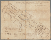
The late John Hopper's farm a…
m
Hopper Farm, showing divisions
m
Plot of farm bounded by N. Ri…
m
Benjamin Booth's lot north si…
m
Captain De Lancey's ground
End of results
|
Top