Click to visit the main New York Public Library Homepage
The New York Public Library
Digital Collections
About Digital Collections
Browse
Search only public domain materials
Items
Collections
Divisions
Home
Search
Browse
About
Search only public domain materials
Items
Collections
Divisions
Digital Collections
Using Images
Using Data
Search
Filtered search
Show filters
Hide filters
Show Only Public Domain
topic
History
109
Cartography
103
Antiquities
59
Celestial charts
50
Constellations
50
More
Less
name
Lepsius, Richard, 1810-1884
39
Flamsteed, John, 1646-1719
30
Beauplan, Guillaume Le Vasseur, sieur de, approximately 1600-
21
Monecke, C
21
Bode, Johann Elert, 1747-1826
20
More
Less
collection
Materīaly po istorīi russkoĭ kartografīi
103
Denkmaeler aus Aegypten und Aethiopien nach den Zeichnungen der von seiner Majestat dem Koenige von Preussen Friedrich Wilhelm IV nach diesen Landern gesendeten und in den Jahren 1842-1845 ausgefuhrten wissenschaftlichen Expedition ..
39
Atlas celeste de Flamsteed, publie en 1776
30
Joannis Elerti Bode Uranographia, sive astrorum descriptio viginti tabulis aeneis incisa ex recentissimis et absolutissimis astronomorum observationibus ..
20
Puteshestvie flota kapitana Sarycheva po sieverovostochnoi chasti Sibiri, Ledovitomu moriu i Vostochnomu okeanu, v prodolzhenie osmi liet, pri Geograficheskoi i astronomicheskoi morskoi ekspeditsii, byvshei pod nachalstvom flota kapitana Billingsa s 1785 po 1793 god
15
More
Less
place
Russia
110
Egypt
66
Arctic regions
22
Africa
8
Nubia
7
More
Less
genre
Maps
262
Prints
139
Illustrations
30
pages (components)
16
Diagrams
6
More
Less
publisher
Tip. S.V. Kulʹzhenko
103
Nicolaische Buchhandlung
39
Chez Delamarche
30
Apud Autorem
20
Tip. Shnora
15
More
Less
division
x
General Research Division
type
x
cartographic
still image
5
text
5
Date Range
to
344 results found
Filtering on:
x
Date
: 1793 - 1906
x
Division
: General Research Division
x
Type
: cartographic
Sort by:
Title
Date created
Date digitized
Sequence
The Jeannette ; Lost In the I…
m
Atlas géologique
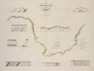
Chart of Smith Sound Showing …
Map showing North Pole, [Map]
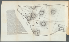
Port Foulke and Vicinity Nort…
North polar chart: track of t…
The countries round the North…
m
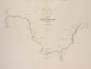
Carte trigonométrique des côt…
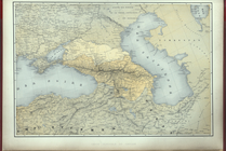
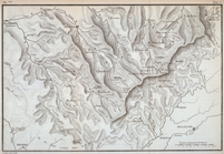
Carte generale du Caucase.
Histoire de la catographie de…
Reisen in Mato Grosso 1887/88
Plan Borodinskago srazheniia,…
Plan d'ensemble de la cité ou…
Plan d'ensemble de la cité ou…
m
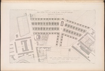
N.Y.C. & H.R.R.R. Electric Zo…
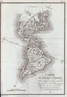
Carte de l'Ancien Continent.
Carte du Nouveau Continent.
[La Carte]
Carte des deux Régions Polair…
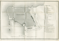
Plan of the city and fortific…
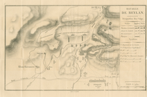
Bataille de Beylan
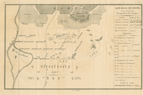
Bataille de Homs
Bataille de Konieh
St. Jean D'Acre
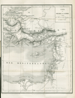
Carte du Théatre de la Guerre
Map showing the boundary of t…
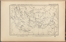
Priznaki granits I ukreplenii…
Region of Bone-Boiling and Sw…
Planta topografica della citt…
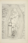
Rouine d'un Tempio d'Iside pr…
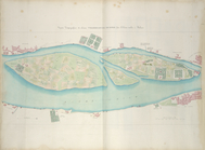
Pianta della città del Cairo.
Pianta topografica di alcune …
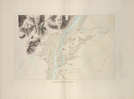
Altra veduta di Carnac; Piant…
Pianta del tempio di Luxor.
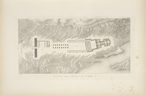
Piano generale di Tebe.
Pianta del tempio di File.
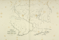
Geognosticheskaia karta bereg…
Karta rasprostraneniia dreves…
Plan chasti goroda Aiguna
Plan Albazinskago ukrepleniia…
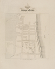
Map of New York City showing …
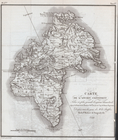
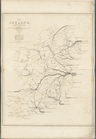
Map of Ireland, to accompany …
Carte figurative de l'instruc…
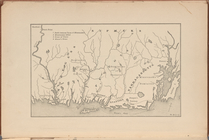
[Pequot War battle sites], fr…
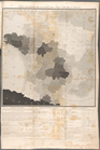
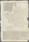
Map of Poland, showing the pa…
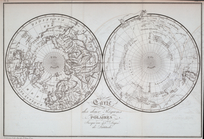
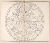
Hemisphere boreal.
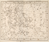
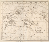
Cassiopée, cépheée, le renne,…
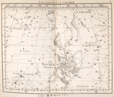
Andromede, persée, le triangl…
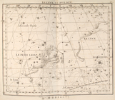
La giraffe, le cocher.
La lynx, le petit lion.
1
2
Previous
Next
1
2
Previous
Next