Click to visit the main New York Public Library Homepage
The New York Public Library
Digital Collections
About Digital Collections
Browse
Search only public domain materials
Items
Collections
Divisions
Home
Search
Browse
About
Search only public domain materials
Items
Collections
Divisions
Digital Collections
Using Images
Using Data
Search
Filtered search
Show filters
Hide filters
Show Only Public Domain
topic
Health aspects
2
History
2
Public health
2
Railroads
2
Administrative and political divisions
1
More
Less
name
Grand Central Terminal (New York, N.Y.)
16
Conewago Canal Company
2
Ruggles, Samuel B. (Samuel Bulkley), 1800-1881
2
United States Sanitary Commission
2
Allen, William Frederick, 1846-1915
1
More
Less
collection
Bancker plans
496
William J. Wilgus papers
17
Century Company records
14
Notes to the Retreat of the English: a Yankee song containing a variety of facts, circumstances and anecdotes, relating to the late invasion of New Orleans by a member of the Mississippi Society K.R
3
Thomas Addis Emmet collection, [legacy collection]
3
More
Less
place
New York
3
New York (N.Y.)
3
New York (State)
2
United States
2
Brooklyn (New York, N.Y.)
1
More
Less
genre
Maps
554
Surveys
496
land surveys
427
Documents
77
Correspondence
14
More
Less
publisher
Fort Dearborn Pub. Co
1
G.W. & C.B. Colton
1
division
x
Manuscripts and Archives Division
type
x
cartographic
text
94
still image
9
Date Range
to
557 results found
Filtering on:
x
Date
: 1793 - 1906
x
Division
: Manuscripts and Archives Division
x
Type
: cartographic
Sort by:
Title
Date created
Date digitized
Sequence
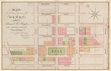
Map of Camp Chase. Drawn on a…
Map illustrating the operatio…
Map of the Lower Division of …
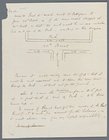
Memo showing plan of new stre…
Map and survey of lands of up…
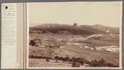
Plan of the town of York Haven
Plan of Conewago Canal
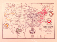
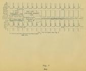
Standard Railway Time (outlin…
m
Carte d'une partie de l'Etat …
A map of the south part of th…
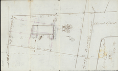
Survey of St. Mary's Church L…
Express level - 1st half
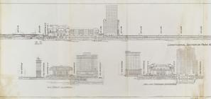
Sections and Elevations - 1st…
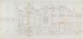
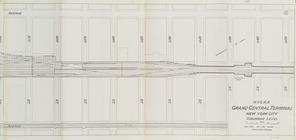
Street Level - 1st half
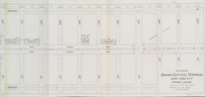
Street Level - 2nd half
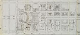
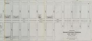
Office level left side
Office level right side
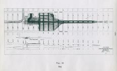
Map. Manhattan's Railroad ent…
Map 10 overhead foot bridges …
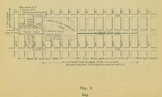
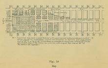
Map depot and yard (figure 5)
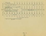
Map station and yard (figure …
Map. Manhattan's Railroad ent…
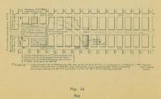
Map (figure 14)
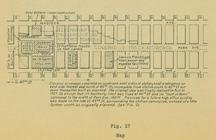
Map (figure 17)
Map (figure 19)
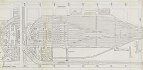
Suburban Level - 1st half.
Suburban Level - 2nd half.
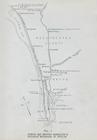
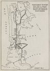
The subway problem: map of in…
Plan for preservation of Audu…
Map, Copake (Columbia County,…
m
Nicholas Carmer and Mary Clar…
m
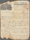
1800 October 29
m
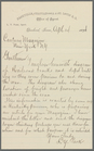
Reid, Harry Fielding
m
Memoranda
m
4 views and a plan of Dr. All…
m
Lehman, A.E
m
Lazear, James B
m
Law, E.M
m
Pearce, Nicholas Bartlett
m
Park, L.Y
m
Hunt, Leavitt
m
Hill, Daniel Harvey
m
Nelson, R.H
m
Florance, George N
m
Washburn, R.C
m
Hendrick's lot in Beaver Stre…
m
Beaver Street and Petticoat L…
m
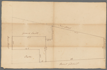
Beaver Street and New Street
m
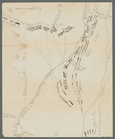
Batavia Lane
m
Peter Schermerhorn's three lo…
1
2
3
Previous
Next
1
2
3
Previous
Next