Click to visit the main New York Public Library Homepage
The New York Public Library
Digital Collections
About Digital Collections
Browse
Search only public domain materials
Items
Collections
Divisions
Home
Search
Browse
About
Search only public domain materials
Items
Collections
Divisions
Digital Collections
Using Images
Using Data
Search
Filtered search
Show filters
Hide filters
Show Only Public Domain
topic
Real property
119
Business enterprises
24
Landowners
8
Administrative and political divisions
3
Cities and towns
3
More
Less
name
x
Beers, F. W. (Frederick W.)
Prindle, A. B
48
Sanford, G. P. (George P.)
22
Beers, S. N
3
Ellis, A. D., active 19th century
3
More
Less
collection
Atlases of the United States
118
Atlases of New York City
48
Maps of North America
6
Maps of New York City and State
4
place
New York (State)
70
New York Metropolitan Area
49
Westchester County (N.Y.)
47
Otsego County
43
Otsego County (N.Y.)
43
More
Less
genre
Maps
172
Atlases
118
Cadastral maps
6
Prints
4
Wall maps
1
publisher
F. W. Beers, A. D. Ellis & others
48
Beers, Ellis & Soule
47
Published by F. W. Beers, A. D. Ellis & G. G. Soule
30
F.W. Beers, A.D. Ellis, and G.G. Soule
2
A. Pomeroy & S.W. Treat, Assistant Publishers G.G. Soule & E.H. Quick
1
More
Less
division
Map Division
176
type
x
cartographic
Date Range
to
176 results found
Filtering on:
x
Date
: 1794 - 1870
x
Name
: Beers, F. W. (Frederick W.)
x
Type
: cartographic
Sort by:
Title
Date created
Date digitized
Sequence
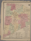
Map of New York and vicinity …
m
Map of the vicinity of Philad…
Map of Washington Co., Pennsy…
Plan of President Township
m
Gillette's map of Oneida Co.,…
m
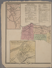
Map of the town of Morrisania…
Plan of Danbury, Fairfield Co…
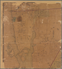
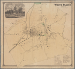
White Plains, Westchester Co.…
Town of Ridgefield, Fairfield…
Town of Bethel, Fairfield Co.…
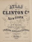
Atlas of Clinton Co., New Yor…
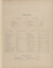
Index.
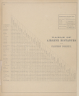
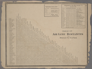
Table of Airline Distances fo…
Sketch of the Early History o…
Sketch of the Early History o…
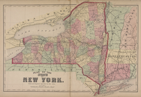
Plan of the State of New York.
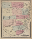
Plan of Clinton Co., N.Y."
The Frontiers [Village]; Clin…
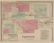
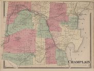
Champlain [Township]
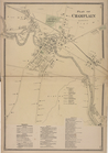
Plan of Champlain [Village]; …
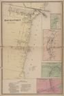
RousesPoint [Village]; Chazy …
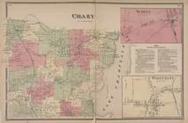
Chazy [Township]; Sciota [Vil…
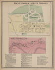
Dannemora and State Prison [V…
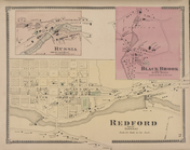
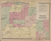
Russia [Village]; Black Brook…
Black Brook [Township]; Black…
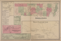
Beekmantown Corners [Village]…
Elsinore Subscriber's Busines…
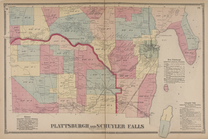
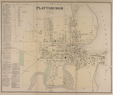
Plattburgh [Village]; Plattbu…
South Plattburgh [Village]; S…
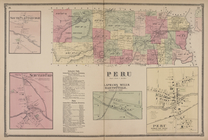
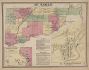
Au Sable [Township]; Birmingh…
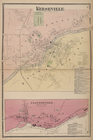
Keeseville [Village]; Keesevi…
U.S. Custom House & P.O., Pla…
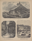
R.W. Adams, Steam Saw Mill, C…
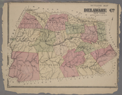
Atlas of Delaware Co., New Yo…
m
Plan of the State of New York.
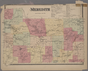
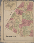
Meredith [Township]; Business…
m
Masonville [Village]; Masonvi…
Table of Air Line Distances f…
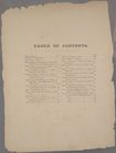
Table of Contents.
m
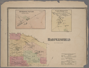
Sidney Centre [Village]; Sidn…
Outline Map of Delaware Co. N…
m
Croton Village [Village]; Fra…
m
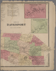
Town of Davenport [Township];…
m
Meredith Square [Village]; Ea…
m
Teedville [Village]; Hales Ed…
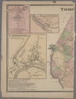
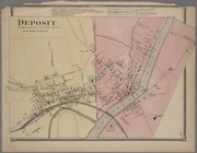
Deposit [Village]
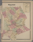
Walton [Township]; New Road P…
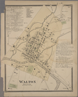
Walton Business Directy. ; Wa…
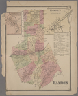
Lansingville [Village]; Hamde…
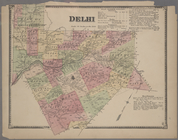
Delhi [Township]; Delhi Busin…