Click to visit the main New York Public Library Homepage
The New York Public Library
Digital Collections
About Digital Collections
Browse
Search only public domain materials
Items
Collections
Divisions
Home
Search
Browse
About
Search only public domain materials
Items
Collections
Divisions
Digital Collections
Using Images
Using Data
Search
Filtered search
Show filters
Hide filters
Show Only Public Domain
topic
Real property
1097
Landowners
374
Administrative and political divisions
369
Railroads
266
Nautical charts
256
More
Less
name
Perris, William
308
United States Coast Survey
255
Bache, A. D. (Alexander Dallas), 1806-1867
205
Burr, David H., 1803-1875
195
Beers, F. W. (Frederick W.)
176
More
Less
collection
Maps of North America
1559
Maps of New York City and State
828
Atlases of the United States
703
Atlases of New York City
532
Bancker plans
465
More
Less
place
New York (State)
1423
New York
536
United States
455
New York (N.Y.)
451
Manhattan (New York, N.Y.)
426
More
Less
genre
Maps
5185
Atlases
677
Surveys
475
land surveys
412
Cadastral maps
304
More
Less
publisher
publisher not identified
275
William Perris
142
U.S. Coast Survey
128
Perris & Browne
124
Chapman and Hall
109
More
Less
division
Map Division
4080
Manuscripts and Archives Division
485
General Research Division
216
Rare Book Division
145
George Arents Collection
53
More
Less
type
x
cartographic
text
197
still image
131
Date Range
to
5,297 results found
Filtering on:
x
Date
: 1794 - 1870
x
Type
: cartographic
Sort by:
Title
Date created
Date digitized
Sequence
1. Grundriss des Ammontempels…
1. Ruines d'un temple d'Ysis …
1. Vue de Thèbes. 2. Plan du …
m
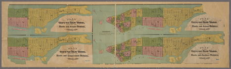
12,000 Square Miles around Ne…
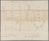
13 lots of ground to be sold …
m
1793 March 18
180 lots on the Marsellis Tra…
m
1800 October 29
m
1800 October 29
m
1800 October 29
m
1801 December 21
m
1801 December 21
m
1803 April 6
m
1810 January 7
m
1810 January 8
1841, showing the dates of th…
1863, West Point: [New York]
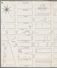
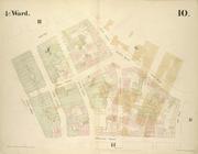
1st & 2nd Wards. [Map bounded…
1st & 3rd Wards. [Map bounded…
1st Ward of NYC: [in draft du…
1st Ward. [Map bounded by Bow…
1st Ward. [Map bounded by Exc…
1st Ward. [Map bounded by Lib…
1st Ward. [Map bounded by Sto…
1st Ward. [Map bounded by Wes…
2nd & 4th Wards. [Map bounded…
2nd Ward. [Map bounded by Bro…
2nd Ward. [Map bounded by Pea…
2nd Ward. [Map bounded by Wil…
m
3 three story brick houses in…
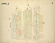
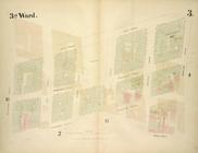
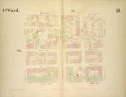
3rd Ward. [Map bounded by Col…
3rd Ward. [Map bounded by Ful…
3rd Ward. [Map bounded by Gre…
3rd Ward. [Map bounded by Rob…
3rd Ward. [Map bounded by Wes…
4 plans of the City of New Yo…
m
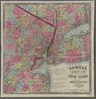
40 miles around New York. H. …
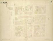
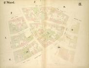
4th Ward. [Map bounded by Cat…
4th Ward. [Map bounded by Gol…
4th Ward. [Map bounded by Pec…
4th Ward. [Map bounded by Roo…
4th Ward.[Map bounded by Oak …
m
51 lots to be sold by R.R. Mi…
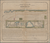
64 Central Park Lots, New Yor…
7th map to accompany Willard'…
m
9th cent. crosses.
A bird's-eye view of the city…
A carefully prepared map of t…
A chart of Delaware Bay and R…
A chart of New York Harbour :…
1
2
3
4
5
6
7
8
9
10
…
21
22
Previous
Next
1
2
3
4
5
6
7
8
9
10
…
21
22
Previous
Next