Click to visit the main New York Public Library Homepage
The New York Public Library
Digital Collections
About Digital Collections
Browse
Search only public domain materials
Items
Collections
Divisions
Home
Search
Browse
About
Search only public domain materials
Items
Collections
Divisions
Digital Collections
Using Images
Using Data
Search
Filtered search
Show filters
Hide filters
Show Only Public Domain
topic
Real property
87
Landowners
45
Administrative and political divisions
29
Post roads
14
Canals
10
More
Less
name
Burr, David H., 1803-1875
99
Rawdon, Clark & Co
79
Rawdon, Wright & Co
79
De Witt, Simeon, 1756-1834
55
New York (State). Surveyor General
48
More
Less
collection
Maps of New York City and State
129
Atlases of the United States
92
Lawrence H. Slaughter Collection of English maps, charts, globes, books and atlases
10
Maps of North America
2
Atlases, gazetteers, guidebooks and other books
1
More
Less
place
x
New York (N.Y.)
New York (State)
137
New York Metropolitan Area
41
Manhattan (New York, N.Y.) -- Maps
37
New Jersey
30
More
Less
genre
Maps
234
Atlases
92
Cadastral maps
1
Military maps
1
Posters
1
More
Less
publisher
Stone and Clark
27
D. H. Burr
26
Stone and Clark,
26
s.n
17
Published by A.T. Goodrich, 124 Broad Way
14
More
Less
division
x
Map Division
type
cartographic
230
text
7
still image
5
Date Range
to
235 results found
Filtering on:
x
Date
: 1796 - 1850
x
Division
: Map Division
x
Place
: New York (N.Y.)
Sort by:
Title
Date created
Date digitized
Sequence
m
A map shewing the extent of t…
Map of Brooklyn during the Ba…
Plan of the city of New York
Van Der Donck's map of New Ne…
Distance map of the state of …
Map of property at New Bright…
Île de New-York, partie de Lo…
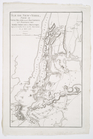
Map of the country thirty mil…
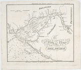
The bay and river of Delaware
A chart of the bar of Sandy H…
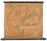
New York
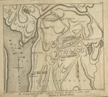
The engagement on the White P…
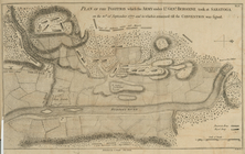
Plan of the position which th…
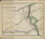
Falls of Niagara and adjacent…
Chart of Long Island Sound, 1…
Entrance to New York Bay from…
A New & Accurate Plan of the …
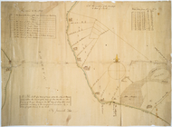
Map of Garret Nostrand's farm…
Map of the country thirty thr…
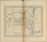
Map of the country thirty mil…
Map of New-York Bay and Harbo…
Map showing the old farms : f…
Map of the real estate in the…
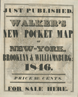
Hooker's new pocket plan of t…
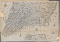
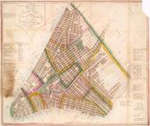
City of New-York
A map of the village of Willi…
Green-wood cemetery
Map of valuable property situ…
Map of 465 valuable building …
Map of the City of New-York w…
A plan of New York Island, pa…
A plan of New York Island, pa…
Map of part of Kingston, N.Y.…
Map of the village of Hermann…
Map of the Lakeland farms, ne…
m
Geological map of Long & Stat…
Green-wood cemetery
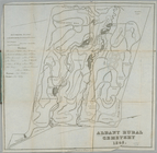
Albany Rural Cemetery
Map of a tract of land called…
City of New-York
Map of the city of New York :…
The Empire State, New York : …
The Fort in New Yorke
Map and plan to illustrate th…
Fort Washington and the north…
Little Falls in 1802.
The Fort of Albany
Albany
Map of New-York Bay and Harbo…
m
Hooker's new pocket plan of t…