Click to visit the main New York Public Library Homepage
The New York Public Library
Digital Collections
About Digital Collections
Browse
Search only public domain materials
Items
Collections
Divisions
Home
Search
Browse
About
Search only public domain materials
Items
Collections
Divisions
Digital Collections
Using Images
Using Data
Search
Filtered search
Show filters
Hide filters
Show Only Public Domain
topic
Real property
5319
Fire insurance
3294
Cities & towns
3086
Administrative and political divisions
635
Landowners
507
More
Less
name
Sanborn Map Company
3085
Beers, F. W. (Frederick W.)
534
Perris, William
308
United States Coast Survey
266
Everts, Ensign & Everts
231
More
Less
collection
Atlases of New York City
3999
Maps of North America
2220
Atlases of the United States
2107
Maps of New York City and State
1125
Bancker plans
414
More
Less
place
New York (State)
5810
New York
816
New York (N.Y.)
590
United States
506
Manhattan (New York, N.Y.)
498
More
Less
genre
Maps
10893
Atlases
2048
Surveys
429
Cadastral maps
421
land surveys
365
More
Less
publisher
Sanborn Map Company
3085
publisher not identified
342
F. W. Beers & Co
148
William Perris
142
U.S. Coast Survey
134
More
Less
division
Map Division
9892
Manuscripts and Archives Division
443
General Research Division
194
Rare Book Division
140
George Arents Collection
53
More
Less
type
x
cartographic
text
219
still image
165
Date Range
to
11,063 results found
Filtering on:
x
Date
: 1798 - 1885
x
Type
: cartographic
Sort by:
Title
Date created
Date digitized
Sequence
Results 1001 - 1050
General map of the anthracite…
Map showing the anthracite co…
Map of the mines of the Panth…
Map of the Shenandoah Valley …
Map of Virginia and West Virg…
Map of the mines, canals, and…
m
Frederick County, Maryland: p…
m
Washington County, Maryland: …
m
The Wyoming Coal Field and it…
Plan of the seat of war : [Vi…
Preliminary sketch of Cherrys…
Map of Talbot County Maryland
Sewerage map of the city of M…
Map of the City of Richmond, …
m
Charleston District, South Ca…
m
The city of Charleston, South…
Plan of the siege of Charlest…
m
Tennessee
m
Map of Maury Co., Tennessee :…
m
Map of Haywood County, Tenn. …
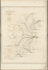
Map of Ireland, to accompany …
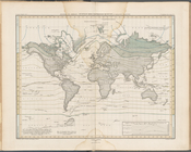
Alexander von Humboldt's Syst…
Carte figurative de l'instruc…
Map of Alaska and adjoining r…
Map of Alaska and adjoining r…
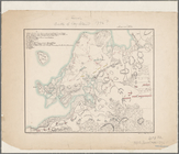
State of Ohio
Alaska and adjoining region
North western America : showi…
Sketch of the battle ground a…
Sketch of the battle ground a…
Map of Brooklyn during the Ba…
Battle of Long Island
Carte du Soudan Occidental dr…
Map of Great Barn Island, New…
Map of the Patuxent & St. Mar…
Map of Shenandoah & Page coun…
Map of Rockingham County, Vir…
m
Map of the city and suburbs o…
m
Map of Loudoun County, Virgin…
Map of part of Virginia, Mary…
Map of Virginia : showing the…
Map of Virginia showing the d…
m
City of Houston, Harris Co., …
Map of Galveston Harbor impr…
m
Map of Ohio and Indiana : exh…
Map of the country upon the B…
Map of the sources of Snake R…
Yellowstone National Park
Yellowstone National Park, Bi…
Chart of Green Bay
1
2
3
4
5
6
7
8
9
10
…
44
45
Previous
Next
1
2
3
4
5
6
7
8
9
10
…
44
45
Previous
Next