Click to visit the main New York Public Library Homepage
The New York Public Library
Digital Collections
About Digital Collections
Browse
Search only public domain materials
Items
Collections
Divisions
Home
Search
Browse
About
Search only public domain materials
Items
Collections
Divisions
Digital Collections
Using Images
Using Data
Search
Filtered search
Show filters
Hide filters
Show Only Public Domain
topic
Maps
31
Celestial charts
20
Constellations
20
History
20
Stars
20
More
Less
name
Carey, Mathew, 1760-1839
69
Manning, Thomas S
44
Kruzenshtern, Ivan Fedorovich, 1770-1846
38
Neele, Samuel John, 1758-1824
28
Jomard, M. (Edme-François), 1777-1862
27
More
Less
collection
Bancker plans
364
Maps of North America
73
Atlases, gazetteers, guidebooks and other books
70
Lawrence H. Slaughter Collection of English maps, charts, globes, books and atlases
54
Puteshestvie vokrug svieta v 1803, 4, 5 i 1806 godakh: po poveleniiu ego imperatorskago velichestva Aleksandra Pervago, nakorabliakh Nadezhde i Neve, pod nachalstvom... kapitana...Kruzenshterna
38
More
Less
place
Europe
50
United States
42
Egypt
32
New York (State)
25
Philadelphia (Pa.)
18
More
Less
genre
Maps
764
Surveys
364
land surveys
310
Prints
84
Documents
57
More
Less
publisher
M. Carey
59
V Morskoi Tipografii
38
Impr. impériale
27
Printed for John Stockdale, Piccadilly. T. Gillett, Printer, Salisbury Square
25
Apud Autorem
20
More
Less
division
Manuscripts and Archives Division
371
Map Division
259
General Research Division
46
Wallach Division: Art & Architecture Collection
38
Rare Book Division
30
More
Less
type
x
cartographic
text
59
still image
9
Date Range
to
771 results found
Filtering on:
x
Date
: 1800 - 1817
x
Type
: cartographic
Sort by:
Title
Date created
Date digitized
Sequence
Plan of the town of Paramarib…
m
A New and Accurate Map of the…
Great Falls of Columbia River
Plan of the town of York Haven
Settlements of the Swiss past…
m
Carte d'une partie de l'Etat …
Map of the American Coast, fr…
East India Islands
Ancient Italy
Countries adjacent to the Med…
m
Nicholas Carmer and Mary Clar…
m
1800 October 29
Environs du Kaire [Cairo]. Pl…
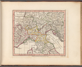
South Germany and Upper Italy…
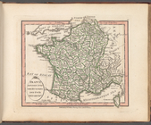
France divided into one hundr…
m
Le Kaire: Plan particulier de…
m
United States of Nth. America
m
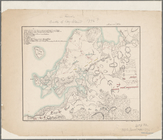
Map of the district of Maine,…
Plan of private claims in Mic…
Map of Brooklyn during the Ba…
Shelton & Kensett's map of th…
m
A map of the state of Louisia…
m
Hendrick's lot in Beaver Stre…
m
Beaver Street and Petticoat L…
m
Batavia Lane
m
Peter Schermerhorn's three lo…
m
Barclay, Robinson, Greenwich …
m
Bowery Lane
m
Bowery Lane between Stanton a…
m
Bowery Lane
m
Lots along Prince, Bowery and…
m
Plot on Bowery lane
m
Eight acres at Bloomingdale
m
1801 December 21
m
John Hopper's at Bloomingdale
m
John Wilkes's five acre lot a…
m
Homestead at Bloomingdale
m
Bloomingdale
m
Bloomingdale - four mile stone
m
Bloomingdale Road to the Comm…
m
Bloomingdale
m
Webber and Van Arden
m
Augustus, Barley and George S…
m
Anne Street
m
Anthony Street
m
Lots near Amity Street, Broad…
m
Abbington and Fitzroy Roads
Plan of the siege of Charlest…
m
John Thurman's lots - Wall St…
m
Pump, Eagle, Second, Third, F…
1
2
3
4
Previous
Next
1
2
3
4
Previous
Next