Click to visit the main New York Public Library Homepage
The New York Public Library
Digital Collections
About Digital Collections
Browse
Search only public domain materials
Items
Collections
Divisions
Home
Search
Browse
About
Search only public domain materials
Items
Collections
Divisions
Digital Collections
Using Images
Using Data
Search
Filtered search
Show filters
Hide filters
Show Only Public Domain
topic
Real property
50
Maps
42
History
30
Landowners
29
Administrative and political divisions
27
More
Less
name
Jomard, M. (Edme-François), 1777-1862
87
Napoleon I, Emperor of the French, 1769-1821
85
Carey, Mathew, 1760-1839
70
De Witt, Simeon, 1756-1834
58
Burr, David H., 1803-1875
53
More
Less
collection
Bancker plans
364
Maps of North America
182
Description de l'Égypte: ou, Recueil des observations et des recherches qui ont été faites en Égypte pendant l'expédition de l'armée française
85
Lawrence H. Slaughter Collection of English maps, charts, globes, books and atlases
84
Maps of New York City and State
82
More
Less
place
New York (State)
116
Egypt
99
New York (N.Y.)
99
United States
84
Europe
61
More
Less
genre
x
Maps
Surveys
365
land surveys
310
Prints
98
Atlases
66
More
Less
publisher
Impr. impériale
85
M. Carey
59
V Morskoi Tipografii
38
publisher not identified
33
Printed for John Stockdale, Piccadilly. T. Gillett, Printer, Salisbury Square
28
More
Less
division
Map Division
534
Manuscripts and Archives Division
371
Rare Book Division
100
General Research Division
66
Wallach Division: Art & Architecture Collection
39
More
Less
type
cartographic
1147
text
73
still image
16
Date Range
to
1,154 results found
Filtering on:
x
Date
: 1800 - 1830
x
Genre
: Maps
Sort by:
Title
Date created
Date digitized
Sequence
Plan of the town of Paramarib…
Isothermal chart, or, View of…
m
A chart of the discoveries of…
m
A New and Accurate Map of the…
m
Carte trigonométrique des côt…
Map and survey of lands of up…
Great Falls of Columbia River
Plan of the town of York Haven
Settlements of the Swiss past…
m
Carte d'une partie de l'Etat …
Map of the American Coast, fr…
Plan of the city and fortific…
East India Islands
Ancient Italy
Countries adjacent to the Med…
m
Nicholas Carmer and Mary Clar…
m
1800 October 29
Environs du Kaire [Cairo]. Pl…
South Germany and Upper Italy…
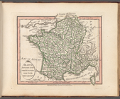
France divided into one hundr…
Map of the western states to …
To accompany Willard's histor…
Sketch of the action on the h…
Sketch of the action on the h…
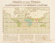
Chart of the world, on Mercat…
m
Le Kaire: Plan particulier de…
m
United States of Nth. America
m
Pianta della città di Pisa
m
Missouri
m
Map of the district of Maine,…
Map of the states of Ohio Ind…
m
Mississippi
Map of the state of Missouri …
Missuri
Map of Pittsburgh and its env…
Plan of private claims in Mic…
Map of the states of Indiana …
m
Charleston District, South Ca…
m
Tennessee
Carte figurative de l'instruc…
Map of Brooklyn during the Ba…
Shelton & Kensett's map of th…
Plan of York Town in Virginia…
m
A map of the state of Louisia…
Plat of the private claims at…
Carte des possessions Russes
m
Hendrick's lot in Beaver Stre…
m
Beaver Street and Petticoat L…
m
Batavia Lane
m
Peter Schermerhorn's three lo…
1
2
3
4
5
Previous
Next
1
2
3
4
5
Previous
Next