Click to visit the main New York Public Library Homepage
The New York Public Library
Digital Collections
About Digital Collections
Browse
Search only public domain materials
Items
Collections
Divisions
Home
Search
Browse
About
Search only public domain materials
Items
Collections
Divisions
Digital Collections
Using Images
Using Data
Search
Filtered search
Show filters
Hide filters
Show Only Public Domain
topic
x
Real property
Fire insurance
3412
Cities & towns
3307
Business enterprises
468
Landowners
432
More
Less
name
Sanborn Map Company
3307
Beers, F. W. (Frederick W.)
356
Perris, William
260
E. Robinson Co
256
Robinson, E. (Elisha)
248
More
Less
collection
Atlases of New York City
4065
Atlases of the United States
1357
Maps of North America
309
Maps of New York City and State
251
Collection of broadside real estate maps announcing auctions of lots in early 19th century New York City
67
More
Less
place
New York (State)
5584
New York
858
Manhattan (New York, N.Y.)
392
Brooklyn (New York, N.Y.)
257
New York (N.Y.)
244
More
Less
genre
Maps
5860
Atlases
1354
Cadastral maps
453
Prints
69
Title pages
43
More
Less
publisher
Sanborn Map Company
3307
E. Robinson Co
209
F. W. Beers & Co
148
Perris & Browne
124
publisher not identified
111
More
Less
division
Map Division
5919
No Division
1
type
cartographic
5924
text
151
still image
31
Date Range
to
6,050 results found
Filtering on:
x
Date
: 1805 - 1894
x
Topic
: Real property
Sort by:
Title
Date created
Date digitized
Sequence
Results 751 - 800
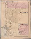
Plate 52: Wakefield, Town & C…
m
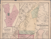
Plates 53 & 54: Town of New R…
m
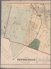
Plate 55 & 56: Part of New Ro…
m
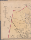
Plates 57 & 58: Part of New R…
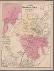
Plate 59: Town of Mamaroneck,…
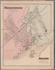
Plate 60: Mamaroneck, Westche…
m
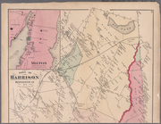
Plates 61 & 62: Town of Harri…
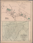
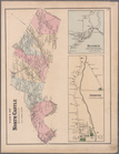
Plate 66: Rye, Town of Westch…
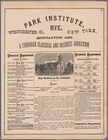
Plate 67: Park Institute, Rye…
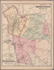
Plate 68: Town of White Plain…
Plate 72: Town of North Castl…
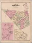
Plate 73: Town of Newcastle, …
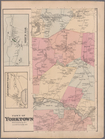
Plate 74: Town of Yorktown, W…
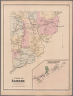
Plate 75: Town of Somers, Wes…
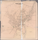
Plate 65: Port Chester, Town …
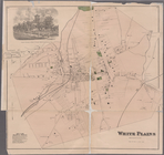
Plate 71: White Plains, Westc…
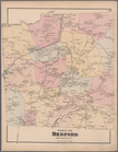
Plate 76: Town of Bedford, We…
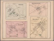
Plate 77: Bedford. - Bedford …
Plate 78: Town of Poundridge,…
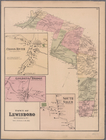
Plate 79: Town of Lewisboro, …
Plate 80: Town of North Salem…
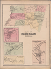
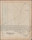
Plate 81: Woodlawn, Westchest…
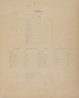
Index.
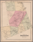
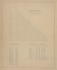
Table of Distances. ; Post Of…
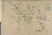
Malone [Village]
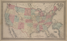
Map of The United States
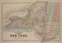
Plan of the states of New Yor…
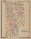
Outline plan of Franklin Co.
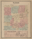
Bangor [Township]; West Bango…
Bangor [Village]; Bagor Busin…
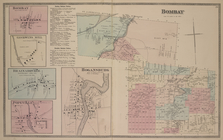
Bombay [Village]; Goodwins Mi…
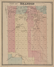
Part of Brandon [Township]
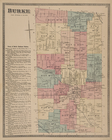
Burke [Township]; Town of Bur…
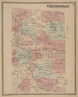
Chateaugay [Township]
Burke [Village]; Burke Busine…
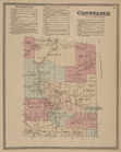
Constable Business Notices. ;…
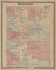
Dickinson [Township]
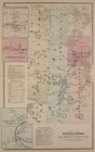
Dickinson Center [Village]; S…
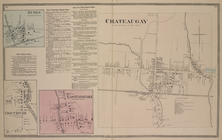
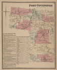
Fort Covington [Township]; Fo…
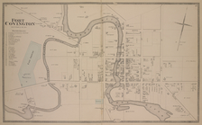
Fort Covington [Village]
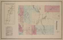
Vermontville [Village]; Frank…
Malone [Township]
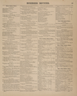
Business Notices.
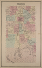
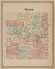
Moira [Township]
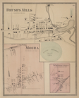
Brush's Mills [Village]; Moir…
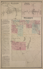
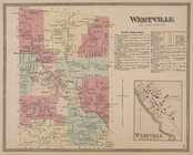
Westville [Township]; Westvil…
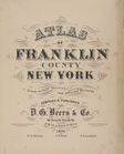
Atlas of Franklin County, New…
Illustrated historical atlas …
Mayville [Village]; Mayville …
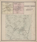
Hamlet [Village]; Cherry Cree…
1
2
3
4
5
6
7
8
9
10
…
24
25
Previous
Next
1
2
3
4
5
6
7
8
9
10
…
24
25
Previous
Next