Click to visit the main New York Public Library Homepage
The New York Public Library
Digital Collections
About Digital Collections
Browse
Search only public domain materials
Items
Collections
Divisions
Home
Search
Browse
About
Search only public domain materials
Items
Collections
Divisions
Digital Collections
Using Images
Using Data
Search
Filtered search
Show filters
Hide filters
Show Only Public Domain
topic
History
6
Description and travel
5
Administrative and political divisions
4
Rivers
4
Bunker Hill, Battle of, Boston, Mass., 1775
3
More
Less
name
Carey, Mathew, 1760-1839
48
Manning, Thomas S
44
Kruzenshtern, Ivan Fedorovich, 1770-1846
37
Jomard, M. (Edme-François), 1777-1862
16
Napoleon I, Emperor of the French, 1769-1821
16
More
Less
collection
Bancker plans
142
Atlases, gazetteers, guidebooks and other books
48
Maps of North America
47
Puteshestvie vokrug svieta v 1803, 4, 5 i 1806 godakh: po poveleniiu ego imperatorskago velichestva Aleksandra Pervago, nakorabliakh Nadezhde i Neve, pod nachalstvom... kapitana...Kruzenshterna
37
Maps of New York City and State
17
More
Less
place
United States
22
Egypt
16
New York (State)
13
United States -- Maps
11
Maps
10
More
Less
genre
x
Maps
Surveys
142
land surveys
110
Prints
45
Documents
32
More
Less
publisher
M. Carey
44
V Morskoi Tipografii
37
Impr. impériale
16
publisher not identified
5
J. Melish
3
More
Less
division
Manuscripts and Archives Division
149
Map Division
136
Wallach Division: Art & Architecture Collection
37
Rare Book Division
19
General Research Division
4
More
Less
type
cartographic
352
text
34
still image
7
Date Range
to
353 results found
Filtering on:
x
Date
: 1810 - 1819
x
Genre
: Maps
Sort by:
Title
Date created
Date digitized
Sequence
Plan of the town of Paramarib…
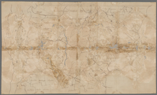
Map and survey of lands of up…
Great Falls of Columbia River
Plan of the town of York Haven
Settlements of the Swiss past…
m
Carte d'une partie de l'Etat …
Map of the American Coast, fr…
Plan of the city and fortific…
East India Islands
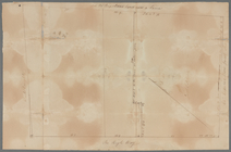
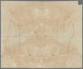
Sketch of the action on the h…
Sketch of the action on the h…
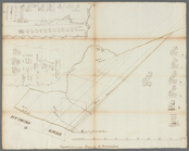
Plan of private claims in Mic…
Shelton & Kensett's map of th…
m
A map of the state of Louisia…
m
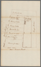
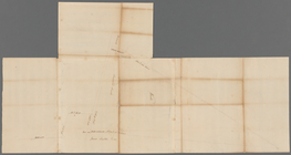
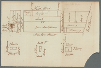
Hendrick's lot in Beaver Stre…
m
Bowery Lane
m
Plot on Bowery lane
m
Lots near Amity Street, Broad…
m
1810 January 8
m
1810 January 7
m
Between Lispenard and Leonard…
m
Plan of a House at Number 5 H…
m
Colonel Magregor's at Greenwi…
m
Greenwich Street between Dyes…
m
College ground and lots
m
Malleshaw's near Fresh Water
m
Sketches showing grades and d…
m
Brookland
m
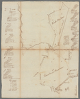
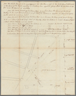
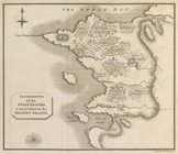
Computations of Staten Island
m
Survey of a tract of land
m
Hawken's and Wood's meadow
m
Caleb Wood's farm
m
Daniel, Ebenezar Bowers's, an…
m
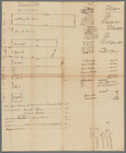
Table of a map to be annexed …
m
Thomas Smith's meadow
m
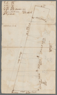
Land adjoining Hudson River a…
m
Calculations for Dr. Bard
m
Part of Vermont
m
Division line between W. N. a…
m
Peter Goelet's near the long …
m
James De Lancey's meadow
m
Thomas Smith's upland
m
Land computations and notes
m
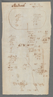
Sherbrook
m
Sketch of Corlears Hook
m
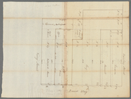
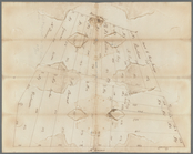
Survey of the fields
m
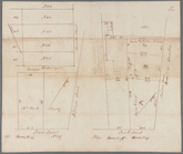
Lots on the west side of Broa…
m
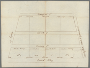
Broadway, Amity Street, Marga…
m
Potters field
m
Lots 24, 25, 26 in the square…
1
2
Previous
Next
1
2
Previous
Next