Click to visit the main New York Public Library Homepage
The New York Public Library
Digital Collections
About Digital Collections
Browse
Search only public domain materials
Items
Collections
Divisions
Home
Search
Browse
About
Search only public domain materials
Items
Collections
Divisions
Digital Collections
Using Images
Using Data
Search
Filtered search
Show filters
Hide filters
Show Only Public Domain
topic
Coastlines
2
Administrative and political divisions
1
Antiquities & archaelogical sites
1
Asia
1
Buildings, structures, etc
1
More
Less
name
Carey, Mathew, 1760-1839
47
Manning, Thomas S
44
Kruzenshtern, Ivan Fedorovich, 1770-1846
36
Melish, John, 1771-1822
6
Tanner, Henry Schenck, 1786-1858
4
More
Less
collection
Atlases, gazetteers, guidebooks and other books
44
Puteshestvie vokrug svieta v 1803, 4, 5 i 1806 godakh: po poveleniiu ego imperatorskago velichestva Aleksandra Pervago, nakorabliakh Nadezhde i Neve, pod nachalstvom... kapitana...Kruzenshterna
36
Maps of North America
13
Lawrence H. Slaughter Collection of English maps, charts, globes, books and atlases
4
Notes to the Retreat of the English: a Yankee song containing a variety of facts, circumstances and anecdotes, relating to the late invasion of New Orleans by a member of the Mississippi Society K.R
3
More
Less
place
United States
9
New York (State)
4
North America
4
Canada
3
Connecticut
3
More
Less
genre
Maps
111
Prints
36
Plans
2
Illustrations
1
Pictorial works
1
More
Less
publisher
M. Carey
44
V Morskoi Tipografii
36
M. Carey,
2
... Published by John Melish
1
A. Constable & Co
1
More
Less
division
Map Division
64
Wallach Division: Art & Architecture Collection
36
Manuscripts and Archives Division
6
Rare Book Division
3
Pforzheimer Collection
1
More
Less
type
x
cartographic
still image
1
text
1
Date Range
to
112 results found
Filtering on:
x
Date
: 1813 - 1816
x
Type
: cartographic
Sort by:
Title
Date created
Date digitized
Sequence
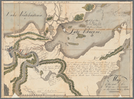
Great Falls of Columbia River
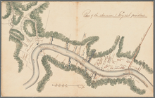
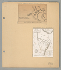
Plan of the town of York Haven
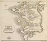
Settlements of the Swiss past…
m
Carte d'une partie de l'Etat …
Map of the American Coast, fr…
m
A map of the state of Louisia…
m
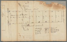
Roosevelt's ground on Lumber,…
Plan showing the disposition …
Map of the seat of the War in…
Plan of the American + Englis…
The state of Rhode-Island
Map of Passamaquoddy Bay: fro…
New Hampshire by recent survey
m
A map of Cabotia: comprehendi…
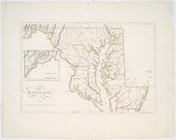
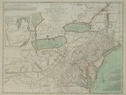
Maryland.
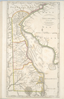
Delaware, from the best autho…
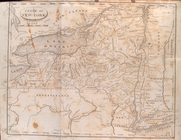
State of New-York for Spaffor…
Bowles's new one-sheet map of…
Plan des forts, batteries et …
m
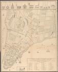
A plan of the city and enviro…
Map of the seat of war in Nor…
A map of the United States an…
A new map of the seat of war
United States of America, sou…
Map of the United States of A…
A Map of the frontier of Brit…
Map of the United States of A…
m
Map of the United States with…
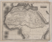
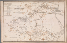
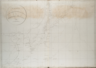
Northern and Central Africa
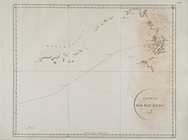
Map of the countries of Fergh…
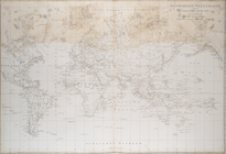
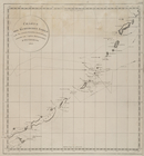
Allgemeine Welt Charte
Charte der Rhede von St. Cath…
Charte der Washington und Men…
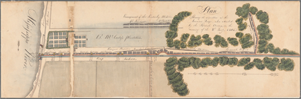
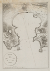
Plan
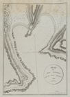
Plan
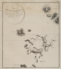
Charte der Ostkûste von Kamts…
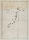
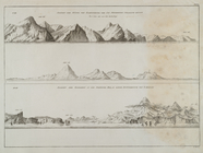
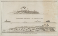
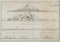
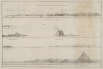
Predstavlenie pikov i mysov
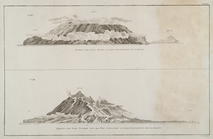
Predstavlenie pikov i mysov
Plan
Charte der Kurilischen Inseln…
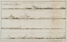
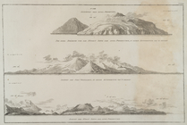
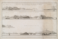
Predstavlenie pikov i mysov
Predstavlenie pikov i mysov
Predstavlenie pikov i mysov
Predstavlenie pikov i mysov
Charte ... Thiels von Iapan u…
Predstavlenie pikov i mysov
Predstavlenie pikov i mysov
Charte von den nordwestlichen…
Charte der Bay Kiusiu
Charte der Westkûste der Inse…