Click to visit the main New York Public Library Homepage
The New York Public Library
Digital Collections
About Digital Collections
Browse
Search only public domain materials
Items
Collections
Divisions
Home
Search
Browse
About
Search only public domain materials
Items
Collections
Divisions
Digital Collections
Using Images
Using Data
Search
Filtered search
Show filters
Hide filters
Show Only Public Domain
topic
Real property
187
Landowners
129
Administrative and political divisions
84
Real propery auctions
67
Canals
40
More
Less
name
Burr, David H., 1803-1875
188
Rawdon, Clark & Co
83
Rawdon, Wright & Co
80
Jomard, M. (Edme-François), 1777-1862
67
Napoleon I, Emperor of the French, 1769-1821
65
More
Less
collection
Maps of North America
336
Maps of New York City and State
169
Atlases of the United States
168
Collection of broadside real estate maps announcing auctions of lots in early 19th century New York City
67
Description de l'Égypte: ou, Recueil des observations et des recherches qui ont été faites en Égypte pendant l'expédition de l'armée française
65
More
Less
place
New York (State)
323
New York (N.Y.)
156
United States
156
Egypt
94
New York
83
More
Less
genre
Maps
1026
Atlases
159
Cadastral maps
99
Prints
69
Illustrations
34
More
Less
publisher
publisher not identified
73
For sale by the principal booksellers
67
Impr. impériale
65
M. Carey
44
Stone and Clark
27
More
Less
division
Map Division
848
Rare Book Division
82
General Research Division
75
Schomburg Manuscripts, Archives and Rare Books Division
21
Manuscripts and Archives Division
10
More
Less
type
x
cartographic
text
17
still image
14
Date Range
to
1,058 results found
Filtering on:
x
Date
: 1814 - 1841
x
Type
: cartographic
Sort by:
Title
Date created
Date digitized
Sequence
Results 251 - 300
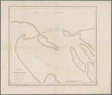
Map illustrating the plan of …
Map of the mouth of Great Sod…
Mining district of Rossie
Plan of the position taken by…
Portland Harbour: with the pl…
Ticonderoga and its dependenc…
Map of Rochester
Massachusetts with Connecticu…
Map exhibiting the route of t…
Plan of Springfield: [Massach…
Plan of the harbour of Boston…
Plan of land & water lots of …
A new map of Arkansas
A diagram of the State of Ala…
Alabama
Map of the state of Alabama
The state of Rhode-Island
New Jersey
Map of Rhode Island and Provi…
Map of the town of Needham, M…
Map of the southern states to…
Map showing part of Winthrop …
Map of Boston and its vicinit…
m
Plan of a survey for a rail-r…
A map of part of Alabama & Fl…
Plan of lands of the South Co…
Plan of land and wharves belo…
Plan showing the proposed ent…
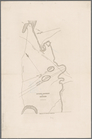
Sketch of the action on the h…
Map of the town of Nantucket,…
A map of the extremity of Cap…
Map of Passamaquoddy Bay: fro…
Plan of house lots in South F…
Plan of Lowell Cemetery: as d…
Map of the town of Ipswich, c…
180 lots on the Marsellis Tra…
City of Washington
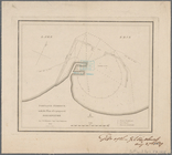
Map of the village of Syracus…
Map of a section of the Andro…
Plan of Lovejoy's narrows fro…
New Hampshire & Vermont
Map of Maine & the disputed …
Maine
Map of a section of the Cobbe…
New Hampshire by recent survey
Map of the County of St. Lawr…
Sketch of the states of Massa…
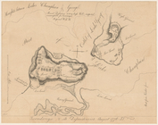
Map of the village at Little …
Map of the city of Buffalo
m
Map of Maine, New Hampshire, …
1
2
3
4
5
Previous
Next
1
2
3
4
5
Previous
Next