Click to visit the main New York Public Library Homepage
The New York Public Library
Digital Collections
About Digital Collections
Browse
Search only public domain materials
Items
Collections
Divisions
Home
Search
Browse
About
Search only public domain materials
Items
Collections
Divisions
Digital Collections
Using Images
Using Data
Search
Filtered search
Show filters
Hide filters
Show Only Public Domain
topic
x
Landowners
Real property
44
Administrative and political divisions
4
Streets
4
Eminent domain
3
More
Less
name
Walling, Henry Francis, 1825-1888
4
Davis, Thomas W. (Surveyor)
3
Meisel, A. (Augustus)
3
Bronson, Isaac, 1760-1838
2
Friend & Aub
2
More
Less
collection
Maps of North America
40
Maps of New York City and State
16
place
New York (State)
16
Massachusetts
14
Boston
7
Boston (Mass.)
3
Michigan
3
More
Less
genre
Maps
56
Cadastral maps
35
Illustrations
1
Military maps
1
publisher
x
publisher not identified
Lith of R.H. Pease
1
Lith. by Berggoetz & Co
1
Lith. of Jones & Newman
1
division
Map Division
56
type
cartographic
56
still image
2
text
1
Date Range
to
56 results found
Filtering on:
x
Date
: 1814 - 1879
x
Publisher
: publisher not identified
x
Topic
: Landowners
Sort by:
Title
Date created
Date digitized
Sequence
Plan of real estate at Harris…
Plan of extension of Devonshi…
Plan of extension of Devonshi…
Map of the mouth of St. Clair…
Sketch of the claims to land …
Map of the city of Saint Paul…
Private claims at Michilimack…
Map of part of Monroe County,…
Hyde Park : [Chicago, Illinoi…
m
Map of Albany County, New Yor…
Plan of a mineral estate situ…
m
Charleston District, South Ca…
Map of lands belonging to Jam…
Map of part of Fauquier Count…
Map of the town of Fairhaven,…
Map of the city of Davenport …
Plat of the private claims at…
Duncan's addition to Michigan…
Plat of the town of Elmhurst,…
Map of Marshfield, Mass.
Map of the town of Raynham, B…
m
Lands in the State of North C…
Map of Venango County, Pennsy…
City of Covington
Map of the oil region, Venang…
A map of part of the land in …
m
Lands in the State of North C…
County and railroad map of th…
Map of the head waters of the…
Map of the city of Newport an…
A plan of the town of Pittsfo…
A plan of the Manor of Philip…
Plan of the easterly part of …
Atherton, St. Lawrence County…
Plan of Springfield: [Massach…
Map of the town of Needham, M…
Map of the town of Tiverton, …
Plan of burnt district (by fi…
Map of the town of Natick, Mi…
Map of the town of Ipswich, c…
Map of Castle Hill & Price's …
Plan of Suffolk Street Distri…
Plan of Church St. district: …
Map of Dobbs Ferry and Hastin…
Map of part of Orange County,…
A plan of the salt marsh and …
Map of Livingston Manor anno …
Parts of 1st ward of the city…
Hartford in 1640
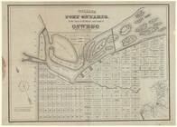
Village of Port Ontario, in t…