Click to visit the main New York Public Library Homepage
The New York Public Library
Digital Collections
About Digital Collections
Browse
Search only public domain materials
Items
Collections
Divisions
Home
Search
Browse
About
Search only public domain materials
Items
Collections
Divisions
Digital Collections
Using Images
Using Data
Search
Filtered search
Show filters
Hide filters
Show Only Public Domain
topic
x
Real property
Landowners
44
Land grants
4
Railroads
4
Streets
4
More
Less
name
Walling, Henry Francis, 1825-1888
4
Davis, Thomas W. (Surveyor)
3
N. Currier (Firm)
3
Pease, Richard H., 1813-1869
3
T. Moore's Lithography
3
More
Less
collection
Maps of North America
58
Maps of New York City and State
25
place
New York (State)
25
Massachusetts
20
Boston
12
Michigan
6
Pennsylvania
5
More
Less
genre
Maps
83
Cadastral maps
65
Wall maps
2
Bathymetric maps
1
Illustrations
1
publisher
x
publisher not identified
Lith of R.H. Pease
1
Lith. by Berggoetz & Co
1
Lith. of Jones & Newman
1
P.A. Mesier & Co., lith
1
division
Map Division
83
type
cartographic
83
still image
2
Date Range
to
83 results found
Filtering on:
x
Date
: 1814 - 1879
x
Publisher
: publisher not identified
x
Topic
: Real property
Sort by:
Title
Date created
Date digitized
Sequence
Plan of Public Garden: showin…
Plan of real estate at Harris…
Plan of land on West Chester …
Plan of extension of Devonshi…
Plan of extension of Devonshi…
Plat of a survey of land "for…
Chicago : correctly copied fr…
Map of the mouth of St. Clair…
Mineral company lands : shade…
Sketch of the claims to land …
Map of the city of Saint Paul…
Map of the town of Huron, Mic…
Private claims at Michilimack…
Map of Port-Lawrence & Vistul…
Map of part of Monroe County,…
Map of the city of Erie : sho…
Hyde Park : [Chicago, Illinoi…
Superior, Douglass County, Wi…
m
Map of Albany County, New Yor…
Plan of a mineral estate situ…
m
The Wyoming Coal Field and it…
Map of Great Barn Island, New…
Railroad map of the City of S…
Plan of Ohio City in the stat…
Map of lands belonging to Jam…
Map of the town of Fairhaven,…
Iron Mountain City : [Missour…
Map of the city of Davenport …
m
Superior, Douglas County, Wis…
Plat of the private claims at…
Whitesboro, Brown Co., W.T.
Plan of the village of Lima o…
Duncan's addition to Michigan…
A compleat map of North-Carol…
Plat of the town of Elmhurst,…
Map of Marshfield, Mass.
Map of the town of Raynham, B…
Map of Venango County, Pennsy…
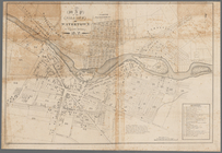
City of Covington
Map of the oil region, Venang…
A map of part of the land in …
Map of the head waters of the…
Map of the River Niagara and …
A map of a tract of land in t…
A plan of the town of Pittsfo…
Map of the upper part of the …
A plan of the Manor of Philip…
Map of pr[op]erty of Union Av…
Map of property at Van Buren …
Map of the village of Waterto…