Click to visit the main New York Public Library Homepage
The New York Public Library
Digital Collections
About Digital Collections
Browse
Search only public domain materials
Items
Collections
Divisions
Home
Search
Browse
About
Search only public domain materials
Items
Collections
Divisions
Digital Collections
Using Images
Using Data
Search
Filtered search
Show filters
Hide filters
Show Only Public Domain
topic
Real property
83
Landowners
56
Administrative and political divisions
36
Railroads
33
History
27
More
Less
name
Königlich Preussisch privilegirte Fallersche Schauspieler-Gesellschaft
8
Gavit, John E., 1817-1874
6
Hayward, George, approximately 1800-
6
Pease, Richard H., 1813-1869
6
Ackerman Lithr
5
More
Less
collection
Maps of North America
220
Maps of New York City and State
72
Yiddish theater collection
8
place
New York (State)
59
Massachusetts
49
Pennsylvania
19
Boston
17
Michigan
17
More
Less
genre
Maps
292
Cadastral maps
68
Geological maps
13
Facsimiles
8
Posters
8
More
Less
publisher
x
publisher not identified
Lith of R.H. Pease
2
D. McLellan, lithographer
1
Engraved & Printed by J. E.Gavit
1
Lith. by Berggoetz & Co
1
More
Less
division
Map Division
292
Dorot Jewish Division
8
type
cartographic
292
text
12
still image
6
Date Range
to
300 results found
Filtering on:
x
Date
: 1814 - 1879
x
Publisher
: publisher not identified
Sort by:
Title
Date created
Date digitized
Sequence
Map of Jersey City and enviro…
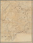
Map of Indian Territory
m
The New York wilderness: Hami…
A topographical map of the st…
Map of Kane County, Illinois,…
Map of New Hampshire, 1816
Railroads of Minneapolis and …
Map of the city of Lynn, Mass…
Plan showing the redoubt, bre…
Plan of real estate at Harris…
Map of Lynn, Mass: (Diphtheri…
Map of the lakes & drives aro…
Southern New England and New …
Map of the state of Wisconsin…
Map of Boston 1875: from A. W…
Index map showing the princip…
Plan exhibiting the system of…
Map of the homestead of the l…
Map of Boston and the country…
Map of parts of Montana, Idah…
Map of Pennsylvania showing p…
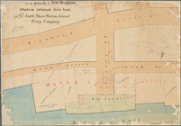
Map of property of New Bright…
Plan of land on West Chester …
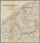
Map of Chautauqua County, N.Y…
Plan of burnt district (by fi…
Map of pr[op]erty of Union Av…
Map of Northern Arizona
Preliminary map of the survey…
A plan of the town of Pittsfo…
Map of the rail roads of the …
Map of Black Point property n…
Map of the Pittsburg & Baltim…
Map of the city of Erie : sho…
m
Outline map showing a new rou…
Hartford in 1640
Map of central Keweenaw Penin…
Enlarged map of the coast fro…
Map of the rail roads of the …
Fragment of a map, covering p…
Parts of 1st ward of the city…
Vernon Co., Mo. : plat of tow…
Nashua River
County and railroad map of th…
Map of the city of Newport an…
Half of an unidentified map s…
Map of Dobbs Ferry and Hastin…
Map of Silver Lake on the Ply…
Hyde Park : [Chicago, Illinoi…
m
Brooklyn City Hall
m
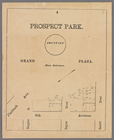
Prospect Park, plaza lots
1
2
Previous
Next
1
2
Previous
Next