Click to visit the main New York Public Library Homepage
The New York Public Library
Digital Collections
About Digital Collections
Browse
Search only public domain materials
Items
Collections
Divisions
Home
Search
Browse
About
Search only public domain materials
Items
Collections
Divisions
Digital Collections
Using Images
Using Data
Search
Filtered search
Show filters
Hide filters
Show Only Public Domain
topic
Post roads
14
Discovery and exploration
8
History
7
Nautical charts
7
Maps
6
More
Less
name
Jomard, M. (Edme-François), 1777-1862
16
Rollinson, William, 1762-1842
16
Goodrich, A. T. (Andrew Thompson), 1789-1845
15
Bridges
14
Napoleon I, Emperor of the French, 1769-1821
14
More
Less
collection
Maps of North America
39
Lawrence H. Slaughter Collection of English maps, charts, globes, books and atlases
17
Maps of New York City and State
17
Atlases of the United States
14
Description de l'Égypte: ou, Recueil des observations et des recherches qui ont été faites en Égypte pendant l'expédition de l'armée française
14
More
Less
place
New York (State)
27
New York (N.Y.)
21
New Jersey
20
Egypt
19
Africa
15
More
Less
genre
Maps
151
Prints
22
Atlases
14
Illustrations
6
Topographic maps
4
More
Less
publisher
A. Bertrand
14
Impr. impériale
14
Published by A.T. Goodrich, 124 Broad Way
14
Pub. by E.M. Blunt for W. Hooker
5
J. Melish
3
More
Less
division
Map Division
100
General Research Division
15
Rare Book Division
15
Schomburg Manuscripts, Archives and Rare Books Division
10
Manuscripts and Archives Division
5
More
Less
type
x
cartographic
still image
8
text
1
Date Range
to
154 results found
Filtering on:
x
Date
: 1816 - 1822
x
Type
: cartographic
Sort by:
Title
Date created
Date digitized
Sequence
m
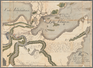
A chart of the discoveries of…
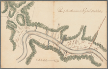
Map and survey of lands of up…
Settlements of the Swiss past…
Plan of the city and fortific…
East India Islands
Sketch of the action on the h…
Sketch of the action on the h…
Map of the state of Missouri …
Shelton & Kensett's map of th…
m
A map of the state of Louisia…
m
Chambers and Reade Street
Map of Florida
m
A map of South Carolina : con…
Plan showing the disposition …
Map of the seat of the War in…
Plan of the American + Englis…
Plan of the position taken by…
Map of Rhode Island and Provi…
Map of Boston and its vicinit…
Sketch of the action on the h…
New Hampshire by recent survey
A geological map of a part of…
Map of the country which was …
Map of the meetings constitut…
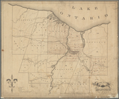
County of Monroe
Carta delle Isole Antille
Africa antiqua
A map of Mexico, Louisiana, a…
Denderah [Dandara] (Tentyris)…
Abydus [Abydos]. Plan des rui…
Achmouneyn (Hermopolis Magna)…
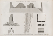
Antinoë [Antinoöpolis]. Plan …
Antinoë [Antinoöpolis]. 1. Pl…
Memphis et environs. Plan gén…
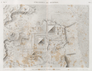
Pyramides de Memphis. Plan to…
Tanis (Sân). Plan des ruines …
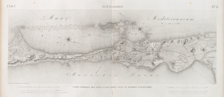
Alexandrie [Alexandria]. Cart…
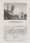
Alexandrie [Alexandria]. 1. V…
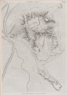
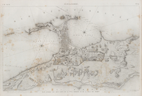
Environs d'Alexandrie [Alexan…
Alexandrie [Alexandria]. Plan…
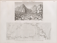
Déserts arabiques. 1. Carte d…
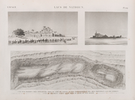
Lacs de Natroun. 1. Vue d'El-…
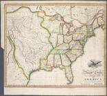
United States of America
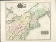
Northern provinces of the Uni…
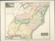
Southern provinces of the Uni…
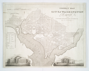
A correct map of the city of …
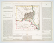
Geographical, statistical, an…
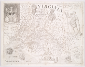
Virginia
m
A map of Virginia : formed fr…
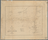
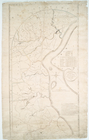
Roads of Newcastle County