Click to visit the main New York Public Library Homepage
The New York Public Library
Digital Collections
About Digital Collections
Browse
Search only public domain materials
Items
Collections
Divisions
Home
Search
Browse
About
Search only public domain materials
Items
Collections
Divisions
Digital Collections
Using Images
Using Data
Search
Filtered search
Show filters
Hide filters
Show Only Public Domain
topic
Post roads
14
Administrative and political divisions
9
Description and travel
9
Nautical charts
9
Discovery and exploration
8
More
Less
name
Jomard, M. (Edme-François), 1777-1862
16
Rollinson, William, 1762-1842
16
Goodrich, A. T. (Andrew Thompson), 1789-1845
15
Bridges
14
Napoleon I, Emperor of the French, 1769-1821
14
More
Less
collection
Maps of North America
48
Lawrence H. Slaughter Collection of English maps, charts, globes, books and atlases
22
Maps of New York City and State
22
Atlases of the United States
14
Description de l'Égypte: ou, Recueil des observations et des recherches qui ont été faites en Égypte pendant l'expédition de l'armée française
14
More
Less
place
New York (State)
29
New York (N.Y.)
24
New Jersey
21
Egypt
19
United States
19
More
Less
genre
Maps
176
Prints
27
Atlases
14
Illustrations
6
Plans
4
More
Less
publisher
A. Bertrand
14
Impr. impériale
14
Published by A.T. Goodrich, 124 Broad Way
14
Ecksteinska tryckeriet
5
Pub. by E.M. Blunt for W. Hooker
5
More
Less
division
Map Division
121
Rare Book Division
19
General Research Division
17
Schomburg Manuscripts, Archives and Rare Books Division
10
Manuscripts and Archives Division
5
More
Less
type
x
cartographic
still image
7
text
5
Date Range
to
180 results found
Filtering on:
x
Date
: 1817 - 1824
x
Type
: cartographic
Sort by:
Title
Date created
Date digitized
Sequence
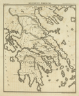
Ancient Greece, [plate follow…
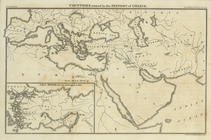
Countries named in the Histor…
m
A chart of the British Channe…
m
A new map of Europe : exhibit…
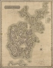
Orkney Islands
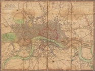
Laurie and Whittle's New map …
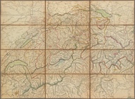
H. Keller's Reisecharte der S…
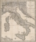
Carta geografica statistica e…
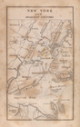
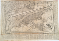
New York and adjacent country.
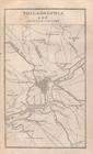
Philadelphia and adjacent cou…
Baltimore, Annapolis, and adj…
Moral and political chart of …
Carte generale de l'Amerique …
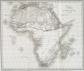
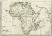
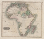
Africa
Afrique: Selon les Dernieres …
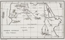
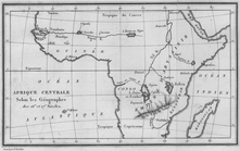
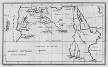
Afrique Centrale: Selon Ptolé…
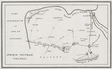
Afrique Centrale: Selon Edris…
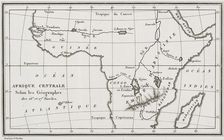
Afrique Centrale: Selon les G…
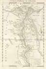
Carte Générale de L'Egypte.
Afrique Occidentale: Montrant…
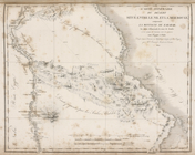
Carte: Des Decouvertes en Afr…
Afrique Occidentale Montrant …
Carte des Decouvertes en Afri…
Afrique, par J. B. Poirson
Afrique Centrale Selon les Ge…
Afrique Centrale. Selon Edris…
Afrique Centrale Selon Ptolem…
Carte Generale de L'Egypte.
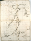
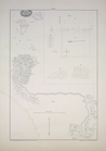
A general sketch of the coast…
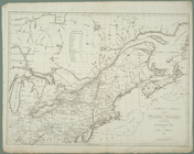
Northern section of the Unite…
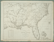
Southern section of the Unite…
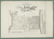
Plan af Philadelphia
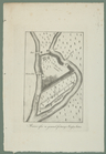
Ruiner efter en gammal fastni…
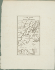
New York med trakten däromkri…
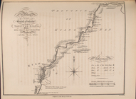
The map of the route of the B…
Map of the route of the Briti…
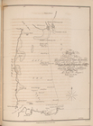
Track of the Barge & Cutter b…
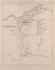
Map of road to the Mountains …
Topographical map of the vall…
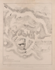
1. Grundriss des Ammontempels…
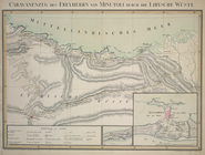
Caravanenzug des Freyherrn vo…
Carte itinéraire du désert si…
Carte de l'oasis de Thèbes, .…
m
Panorama des Rheins und seine…
Africa
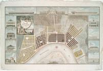
Plan of the city and suburbs …
A map of the states of Connec…
m
Baltimore in 1752
Map of the United States : wi…
Map of the state of New-York …