Click to visit the main New York Public Library Homepage
The New York Public Library
Digital Collections
About Digital Collections
Browse
Search only public domain materials
Items
Collections
Divisions
Home
Search
Browse
About
Search only public domain materials
Items
Collections
Divisions
Digital Collections
Using Images
Using Data
Search
Filtered search
Show filters
Hide filters
Show Only Public Domain
topic
Administrative and political divisions
5
Canals
4
Altitudes
2
Charts, diagrams, etc
2
Maps
1
More
Less
name
Tanner, Henry Schenck, 1786-1858
4
Böye, Herman
2
Ode, H. (Henri)
2
Perkins, Joseph, 1788-1842
2
Vandermaelen, Philippe, 1795-1869
2
More
Less
collection
Maps of North America
13
Maps of New York City and State
5
Maps of Europe
3
Atlases, gazetteers, guidebooks and other books
2
Forces productives et commerciales de la France
1
More
Less
place
Europe
3
New York (State)
3
United States
3
United States -- Maps
3
Virginia
3
More
Less
genre
Maps
25
Road maps
1
Surveys
1
Topographic maps
1
publisher
H.S. Tanner
2
publisher not identified
2
s.n
2
Bachelier
1
E. Ely
1
More
Less
division
Map Division
24
General Research Division
1
type
x
cartographic
text
1
Date Range
to
25 results found
Filtering on:
x
Date
: 1826 - 1827
x
Type
: cartographic
Sort by:
Title
Date created
Date digitized
Sequence
m
Pianta della città di Pisa
Missuri
Carte figurative de l'instruc…
Map of the district through w…
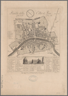
Map of Rochester
Plan of Lovejoy's narrows fro…
Kaart van Nieuw Nederland: be…
A map of the New England stat…
Map of reconnaissance exhibit…
m
Map of the state of Virginia
Map of the State of New York …
Map of the state of New York …
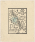
A new map of the city of New …
Map of the country between Wa…
Map of the state of Virginia
Virginia, Maryland, and Delaw…
Line of the Morris Canal, New…
Map of the United States : dr…
Map of the United States : dr…
Map of the United States, con…
m
A map of the state of Virgini…
m
Panorama des Rheins und seine…
Iles Marianes
Guyanes
Nouvelle carte itinéraire de …
End of results
|
Top