Click to visit the main New York Public Library Homepage
The New York Public Library
Digital Collections
About Digital Collections
Browse
Search only public domain materials
Items
Collections
Divisions
Home
Search
Browse
About
Search only public domain materials
Items
Collections
Divisions
Digital Collections
Using Images
Using Data
Search
Filtered search
Show filters
Hide filters
Show Only Public Domain
topic
Real property
45
Landowners
26
Administrative and political divisions
18
Canals
9
Description and travel
9
More
Less
name
Burr, David H., 1803-1875
54
De Witt, Simeon, 1756-1834
54
Rawdon, Clark & Co
53
Dépôt de la guerre (France)
51
Jacotin, Pierre, 1765-1827
51
More
Less
collection
Maps of North America
56
Atlases of the United States
52
Description de l'Égypte: ou, Recueil des observations et des recherches qui ont été faites en Égypte pendant l'expédition de l'armée française
51
Maps of New York City and State
42
Principles of geology: being an attempt to explain the former changes of the earth's surface, by reference to causes now in operation
8
More
Less
place
New York (N.Y.)
68
New York (State)
66
Egypt
57
United States
19
Manhattan (New York, N.Y.) -- Maps
14
More
Less
genre
Maps
239
Atlases
52
Prints
15
Illustrations
8
Diagrams
6
More
Less
publisher
Impr. impériale
51
D. H. Burr
26
Stone and Clark
26
publisher not identified
11
s.n
9
More
Less
division
Map Division
161
Rare Book Division
58
General Research Division
25
Milstein Division
2
Schomburg Manuscripts, Archives and Rare Books Division
2
More
Less
type
x
cartographic
text
3
still image
2
Date Range
to
252 results found
Filtering on:
x
Date
: 1827 - 1831
x
Type
: cartographic
Sort by:
Title
Date created
Date digitized
Sequence
m
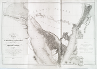
A New and Accurate Map of the…
Colony of Liberia, on the Wes…
m
Carte trigonométrique des côt…
Map of the Lower Division of …
Carte de l'Ancien Continent.
Carte du Nouveau Continent.
[La Carte]
Carte des deux Régions Polair…
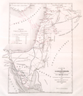
Map of the western states to …
To accompany Willard's histor…
Chart of the world, on Mercat…
m
Missouri
Map of the territories of Mic…
An improved map of the survey…
m
Map of Kentucky and Tennessee…
m
Mississippi
m
The travellers pocket map of …
Map of Pittsburgh and its env…
m
Tennessee
Carte figurative de l'instruc…
Plat of the private claims at…
m
Survey of the Allegheny River…
Map of the states of North & …
Réduction à la meme échelle d…
Carte de l'Arabie Pétrée levé…
Carte de l'Arabie Pétrée indi…
m
Map of the state of Georgia: …
Map of the district through w…
Plan and site for a royal pal…
Map of the territory of Flori…
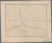
Map of the mouth of big Sandy…
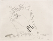
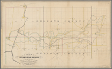
Map of Tonawanda Swamp in the…
Map of the mouth of Great Sod…
Portland Harbour: with the pl…
Map of Rochester
Massachusetts with Connecticu…
New Jersey
m
Plan of a survey for a rail-r…
Plan of house lots in South F…
Map of the village at Little …
Boston and Albany Rail Road: …
Profile of a survey for a rai…
Map of the United States and …
Kaart van Nieuw Nederland: be…
A map of the late Jackson Est…
This colour'd map exhibits a …
Map of the country embracing …
Map of the United States and …
Map of the Eastern States: to…
New England states
1
2
Previous
Next
1
2
Previous
Next