Click to visit the main New York Public Library Homepage
The New York Public Library
Digital Collections
About Digital Collections
Browse
Search only public domain materials
Items
Collections
Divisions
Home
Search
Browse
About
Search only public domain materials
Items
Collections
Divisions
Digital Collections
Using Images
Using Data
Search
Filtered search
Show filters
Hide filters
Show Only Public Domain
topic
Administrative and political divisions
5
Landowners
2
Nautical charts
2
Real property
2
Altitudes
1
More
Less
name
Hooker, William
4
Burr, David H., 1803-1875
2
De Witt, Simeon, 1756-1834
2
Harrison, D. R
2
Peabody & Co
2
More
Less
collection
Maps of New York City and State
11
I. N. Phelps Stokes Collection of American Historical Prints
1
Lawrence H. Slaughter Collection of English maps, charts, globes, books and atlases
1
Samuel B. Ruggles papers, 1801-1881
1
place
x
New York (N.Y.)
Manhattan (New York, N.Y.)
5
New York (State)
4
Manhattan (New York, N.Y.) -- Maps
3
New York (N.Y.) -- Maps
3
More
Less
genre
x
Maps
publisher
s.n
3
Published by Simeon De Witt, surveyor general
2
I.T. Hinton and Simpkin and Marshall
1
Now publishing by Peabody & Co., Broadway,
1
Peabody & Co
1
More
Less
division
Map Division
12
Manuscripts and Archives Division
1
Wallach Division: Print Collection
1
type
cartographic
14
Date Range
to
14 results found
Filtering on:
x
Date
: 1830 - 1832
x
Genre
: Maps
x
Place
: New York (N.Y.)
Sort by:
Title
Date created
Date digitized
Sequence
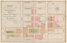
Map of the Lower Division of …
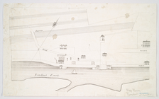
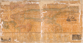
A chart of the bar of Sandy H…
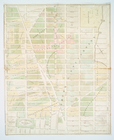
Map showing the old farms : f…
Map of the real estate in the…
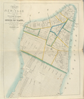
Map of part of Kingston, N.Y.…
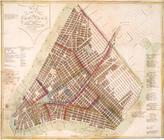
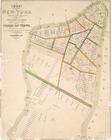
Map of the city of New York :…
Map of the city of New-York
Map of the city and county of…
Map of the city and county of…
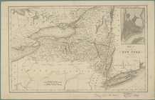
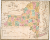
Map of the state of New York …
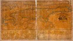
Long Island Sound from New Yo…
Map of the state of New York
Map of the city of New-York
Map of the city of New York.
End of results
|
Top