Click to visit the main New York Public Library Homepage
The New York Public Library
Digital Collections
About Digital Collections
Browse
Search only public domain materials
Items
Collections
Divisions
Home
Search
Browse
About
Search only public domain materials
Items
Collections
Divisions
Digital Collections
Using Images
Using Data
Search
Filtered search
Show filters
Hide filters
Show Only Public Domain
topic
Real property
2
Administrative and political divisions
1
Landowners
1
Nautical charts
1
Swamps
1
name
Anderson, Philander, 1810?-1853
1
Annin & Smith
1
Blake, George S.(George Smith), 1803-1871
1
Carr, J. Wilson
1
Gedney, Thomas R., -1857
1
More
Less
collection
Maps of North America
5
Maps of New York City and State
1
place
Massachusetts
2
Atlantic Ocean
1
Belvidere (Lowell, Mass.)
1
Framingham
1
Framingham (Mass.)
1
More
Less
genre
x
Maps
Cadastral maps
2
Nautical charts
1
Surveys
1
publisher
x
publisher not identified
division
Map Division
6
type
cartographic
6
Date Range
to
6 results found
Filtering on:
x
Date
: 1830 - 1832
x
Genre
: Maps
x
Publisher
: publisher not identified
Sort by:
Title
Date created
Date digitized
Sequence
m
Map of the state of Georgia: …
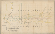
Map of Tonawanda Swamp in the…
Chart of Narraganset Bay : su…
Plan of house lots in South F…
Map of the town of Ipswich, c…
Plan of the town of Lowell an…