Click to visit the main New York Public Library Homepage
The New York Public Library
Digital Collections
About Digital Collections
Browse
Search only public domain materials
Items
Collections
Divisions
Home
Search
Browse
About
Search only public domain materials
Items
Collections
Divisions
Digital Collections
Using Images
Using Data
Search
Filtered search
Show filters
Hide filters
Show Only Public Domain
topic
Real property
380
Landowners
189
Administrative and political divisions
156
Nautical charts
151
Atlases
110
More
Less
name
Perris, William
166
United States Coast Survey
152
Burr, David H., 1803-1875
135
Bache, A. D. (Alexander Dallas), 1806-1867
131
Society for the Diffusion of Useful Knowledge (Great Britain)
114
More
Less
collection
Maps of North America
665
Maps of New York City and State
451
Atlases of New York City
194
Atlases of the United States
120
Lawrence H. Slaughter Collection of English maps, charts, globes, books and atlases
112
More
Less
place
New York (State)
556
New York
273
New York (N.Y.)
236
Manhattan (New York, N.Y.)
212
United States
182
More
Less
genre
Maps
1767
Cadastral maps
167
Nautical charts
123
Prints
102
Atlases
94
More
Less
publisher
William Perris
142
publisher not identified
132
Chapman and Hall
109
U.S. Coast Survey
84
For sale by the principal booksellers
67
More
Less
division
Map Division
1620
General Research Division
97
George Arents Collection
52
Rare Book Division
24
Schomburg Manuscripts, Archives and Rare Books Division
12
More
Less
type
x
cartographic
still image
85
text
70
Date Range
to
1,830 results found
Filtering on:
x
Date
: 1834 - 1856
x
Type
: cartographic
Sort by:
Title
Date created
Date digitized
Sequence
Results 251 - 300
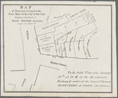
Map of three lots of land in …
m
Map of Maine: constructed fro…
Improved map of the territori…
m
An improved edition of a map …
Map of the southern part of M…
m
Map of the states of Michigan…
Ohio boundary, no. 111, south…
Sketch of the public surveys …
Sketch of the public surveys …
m
A map of Schuylkill County, P…
m
Kentucky and Tennessee
Key West Harbor and its appro…
m
Norman's plan of New Orleans …
Preliminary chart of Ship Isl…
Kentucky
Reconnaissance of Pass Fourch…
m
Map of Clinton Co., New York:…
Hydrographical basin of the u…
Map of the mouth of St. Clair…
Diagram of the state of Misso…
H. Diagram of the State of Mi…
Diagram of the state of Misso…
New map of Minnesota : carefu…
Geological map of Keweenaw Po…
Plan of the city of Philadelp…
Traveller's map of Michigan, …
Diagram of part of the State …
Map of the surveyed part of M…
Survey of the mouth of Galien…
General map to accompany the …
Geological map of Isle Royale…
Section and diagram illustrat…
Sketch of the public surveys …
Diagram of the state of Michi…
Survey of the mouth of Clinto…
Sketch of the claims to land …
Township no. 74 N. range no.…
Map of the northern peninsula…
Map of the city of Saint Paul…
m
Chapman's new sectional map o…
Map of Minnesota
Sketch of the public surveys …
Sketch of the public surveys …
Works at Stony Point and Verp…
Wisconsin, a sectional map wi…
Ohio lands to be sold by Irvi…
Chapman's sectional map of Wi…
Map of the city of Nauvoo : d…
Map of the Stoney Creek bitum…
Topographical map of lands be…
1
2
3
4
5
6
7
8
Previous
Next
1
2
3
4
5
6
7
8
Previous
Next