Click to visit the main New York Public Library Homepage
The New York Public Library
Digital Collections
About Digital Collections
Browse
Search only public domain materials
Items
Collections
Divisions
Home
Search
Browse
About
Search only public domain materials
Items
Collections
Divisions
Digital Collections
Using Images
Using Data
Search
Filtered search
Show filters
Hide filters
Show Only Public Domain
topic
Parks
426
Fires
281
Great Fire, Boston, Mass., 1872
258
Streets
156
Hydraulic facilities
142
More
Less
name
Soule, John P
209
Adams, S. F., 1844-
140
Kilburn Brothers
119
J.W. and J.S. Moulton (Firm)
115
C.H. Shute & Son
102
More
Less
collection
Robert N. Dennis collection of stereoscopic views
4588
Maps of North America
182
Emmet Collection of Manuscripts Etc. Relating to American History
18
Maps of New York City and State
13
I. N. Phelps Stokes Collection of American Historical Prints
9
More
Less
place
x
Massachusetts
Boston (Mass.)
1568
Boston
1192
Martha's Vineyard (Mass.)
481
Boston Common (Boston, Mass.)
159
More
Less
genre
Photographs
4589
Stereographs
4588
Maps
196
Cadastral maps
32
Prints
29
More
Less
publisher
C.H. Shute & Son and R.G. Shute
120
S.F. Adams
113
J.L. Lovell
87
H.P. McIntosh
85
J. Freeman
61
More
Less
division
Wallach Division: Photography Collection
4586
Map Division
196
Wallach Division: Print Collection
32
Rare Book Division
7
General Research Division
3
More
Less
type
still image
4638
cartographic
196
text
1
Date Range
to
4,833 results found
Filtering on:
x
Date
: 1835 - 1882
x
Place
: Massachusetts
x
Rights
: Public Domain
Sort by:
Title
Date created
Date digitized
Sequence
m
Scene on Boston Common
m
Boston slave riot, and trial …
Map of the state of New York:…
Map of the rail roads of the …
Map of the rail-roads of the …
Map of the rail roads of the …
View from Mt. Holyoke
Fourth of July festivities at…
Siege of Boston
Plan of Public Garden: showin…
Back Bay and Parker Hill park…
Plan of burnt district (by fi…
Plan of real estate at Harris…
Map of the water region: adja…
Plan of main ship channel in …
No. III, changes in the bed o…
Sketch of the Battle of Bunke…
Plan showing the redoubt, bre…
Map of Boston for 1878: Publi…
Plan of Charles River and War…
Plan of land on West Chester …
Map of Boston and the country…
Map of New England, with adja…
Map showing the New York and …
Plan of extension of Devonshi…
Plan of extension of Devonshi…
Boston with Charlestown and R…
No. I, changes in the bed of …
Plan for the occupation of th…
Night attack on the court hou…
Church of the fugitive slaves…
The maypole of Merry Mount, 1…
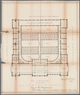
First Floor Plan
Second Floor Plan
Plan of the 2nd Floor
Map of the town of Blackstone…
Map of the city of Chelsea: f…
Map of the town of Fairhaven,…
Map of Gloucester, Cape Ann: …
Preliminary sketch showing th…
A sketch map of a portion of …
Map of Massachusetts: to acco…
Index map showing the princip…
Lynn Harbor, Massachusetts 18…
Historical map of Nantucket
Preliminary chart of Nantucke…
Franklin County
Map of the town of Taunton: w…
Map of the city of Worcester
Gen. Washington's Revolutiona…
1
2
3
4
5
6
7
8
9
10
…
19
20
Previous
Next
1
2
3
4
5
6
7
8
9
10
…
19
20
Previous
Next