Click to visit the main New York Public Library Homepage
The New York Public Library
Digital Collections
About Digital Collections
Browse
Search only public domain materials
Items
Collections
Divisions
Home
Search
Browse
About
Search only public domain materials
Items
Collections
Divisions
Digital Collections
Using Images
Using Data
Search
Filtered search
Show filters
Hide filters
Show Only Public Domain
topic
Real property
1744
Parks
1185
Streets
269
Transportation facilities
166
Landscape architecture facilities
155
More
Less
name
G.W. Bromley & Co
1470
E. & H.T. Anthony (Firm)
495
Bromley, George Washington
405
Bromley, Walter Scott
404
Perris, William
258
More
Less
collection
Robert N. Dennis collection of stereoscopic views
2353
Atlases of New York City
1752
Maps of New York City and State
319
Changing New York
93
Collection of broadside real estate maps announcing auctions of lots in early 19th century New York City
46
More
Less
place
x
Manhattan (New York, N.Y.)
New York (State)
4519
New York
4179
New York (N.Y.)
2933
Central Park (New York, N.Y.)
1022
More
Less
genre
Photographs
2452
Stereographs
2353
Maps
2076
Cadastral maps
62
Index maps
44
More
Less
publisher
G.W. Bromley & Co
1422
Perris & Browne
124
William Perris
105
G.W. Bromley
49
E. & H.T. Anthony (Firm)
33
More
Less
division
Wallach Division: Photography Collection
2448
Map Division
1987
Wallach Division: Print Collection
14
Milstein Division
9
Wallach Division: Picture Collection
4
More
Less
type
still image
2475
cartographic
2114
text
73
Date Range
to
4,600 results found
Filtering on:
x
Date
: 1835 - 1933
x
Place
: Manhattan (New York, N.Y.)
x
Rights
: Public Domain
Sort by:
Title
Date created
Date digitized
Sequence
m
Maps of property in the city …
m
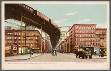
The Elevated at Eighth Avenue…
The Evening Mail's complete m…
Tracts and farms with street …
Carl Schurz Park
Park between 35th and 36th St…
Hagstrom's map of lower New Y…
m
Riverside Park
m
Map of Manhattan showing the …
Block sketch 1679, New York C…
m
Hammond's complete map of New…
Colonial Park
Rand McNally Map of Brooklyn
City Hall Park
m
Tentative height districts, M…
m
Tentative use districts, Manh…
Freight terminal map of New Y…
Center of New York, first cit…
New-York City, County, and vi…
Sketch map of the city of New…
New map of the great metropol…
Map of the Harlem River and S…
Hammond's new guide map of Ma…
Block line map of the heavy v…
m
Manhattan borough and part of…
m
Rand-McNally standard map of …
m
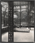
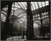
Penn. Station, Interior
m
Penn. Station, Interior
m
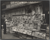
Newsstand, 32nd Street and Th…
m
Murray Hill Hotel, From Park …
m
Hagstrom's map of upper New Y…
Williams' map of boroughs of …
Map of boroughs of Manhattan …
m
Hammond's new guide map of Ma…
m
Data for population from cens…
m
Taunton new guide map and dir…
m
Sanitary & topographical map …
m
Topographical map of New York…
Map of the 23rd and 24th ward…
City guide
Map of New York City : showin…
Hagstrom's New York house-num…
m
Financial district map of New…
m
Borough of Manhattan, 300 foo…
Map of the borough of Manhatt…
Block no. 86 : confidential r…
m
Street guide of Manhattan and…
Map of the borough of Manhatt…
Greater New York's Census dis…
m
Rand McNally commercial map o…
1
2
3
4
5
6
7
8
9
10
…
18
19
Previous
Next
1
2
3
4
5
6
7
8
9
10
…
18
19
Previous
Next