Click to visit the main New York Public Library Homepage
The New York Public Library
Digital Collections
About Digital Collections
Browse
Search only public domain materials
Items
Collections
Divisions
Home
Search
Browse
About
Search only public domain materials
Items
Collections
Divisions
Digital Collections
Using Images
Using Data
Search
Filtered search
Show filters
Hide filters
Show Only Public Domain
topic
Atlases
110
Geography
110
Real property
97
Landowners
64
Administrative and political divisions
39
More
Less
name
Burr, David H., 1803-1875
122
Society for the Diffusion of Useful Knowledge (Great Britain)
113
J. & C. Walker (Firm)
105
Rawdon, Clark & Co
30
Rawdon, Wright & Co
29
More
Less
collection
Maps of North America
161
Atlases of the United States
120
Lawrence H. Slaughter Collection of English maps, charts, globes, books and atlases
111
Maps of New York City and State
94
Collection of broadside real estate maps announcing auctions of lots in early 19th century New York City
35
More
Less
place
New York (State)
177
Great Britain
113
United States
90
New York (N.Y.)
64
Manhattan (New York, N.Y.)
40
More
Less
genre
Maps
571
Atlases
94
Cadastral maps
58
Prints
29
Illustrations
21
More
Less
publisher
Chapman and Hall
109
For sale by the principal booksellers
67
publisher not identified
40
Stone and Clark,
26
S. E. Morse & co.,
18
More
Less
division
Map Division
530
General Research Division
28
Rare Book Division
11
Schomburg Manuscripts, Archives and Rare Books Division
5
Schomburg Jean Blackwell Hutson Research and Reference Division
3
More
Less
type
x
cartographic
still image
5
text
5
Date Range
to
583 results found
Filtering on:
x
Date
: 1836 - 1844
x
Type
: cartographic
Sort by:
Title
Date created
Date digitized
Sequence
Results 251 - 300
m
Map of the states of North Ca…
A map of part of Alabama & Fl…
Plan of lands of the South Co…
Plan of land and wharves belo…
Plan of lots on Bunker Hill
Plan showing the proposed ent…
A map of the extremity of Cap…
Plan of East Boston: exhibiti…
Plan of Lowell Cemetery: as d…
180 lots on the Marsellis Tra…
City of Washington
Map of a section of the Andro…
Map of Maine & the disputed …
Map of a section of the Cobbe…
Map of the County of St. Lawr…
Sketch of the states of Massa…
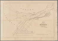
Map of the city of Buffalo
m
Map of Maine, New Hampshire, …
Nieu Nederlandt
m
Map of that portion of her ma…
Part of the United States, Lo…
m
Topographical map of Massachu…
A map of Vinland: from accoun…
Map of New Netherland which w…
m
Niev Nederlandt
A geological map of Massachus…
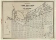
Village of Port Ontario, in t…
Map of the vicinity of Buffal…
Map of New Netherland
A plan of Greenville, Norwich…
March of the Queens Rangers: …
m
Geological map of the State o…
A map of the confluence of th…
Agricultural and geological m…
A map of a portion of the Ind…
Part of the boundary between …
Mitchell's travellers guide t…
Part of the boundary between …
Part of the boundary between …
Carta particolare della nuoua…
Geology of the Genesee River
Map to illustrate the sketche…
Map to Illustrate the Route o…
Cataraugus harbor and the pub…
A new map of New York: with i…
Map of the city of Rochester:…
Karte von Amerika: zum gebrau…
Map of the eastern townships …
Dodge expedition route map fr…
Map illustrating the plan of …
1
2
3
Previous
Next
1
2
3
Previous
Next