Click to visit the main New York Public Library Homepage
The New York Public Library
Digital Collections
About Digital Collections
Browse
Search only public domain materials
Items
Collections
Divisions
Home
Search
Browse
About
Search only public domain materials
Items
Collections
Divisions
Digital Collections
Using Images
Using Data
Search
Filtered search
Show filters
Hide filters
Show Only Public Domain
topic
Atlases
110
Geography
110
Real property
56
Administrative and political divisions
40
Railroads
31
More
Less
name
Burr, David H., 1803-1875
119
Society for the Diffusion of Useful Knowledge (Great Britain)
113
J. & C. Walker (Firm)
104
Rawdon, Clark & Co
29
Rawdon, Wright & Co
29
More
Less
collection
Maps of North America
150
Atlases of the United States
117
Lawrence H. Slaughter Collection of English maps, charts, globes, books and atlases
111
Maps of New York City and State
105
Incidents of travel in Yucatan: By John L. Stephens ... Illustrated by 120 engravings...
7
More
Less
place
New York (State)
145
Great Britain
112
New York (N.Y.)
74
United States
55
New York Metropolitan Area
36
More
Less
genre
Maps
523
Atlases
94
Prints
19
Cadastral maps
17
Illustrations
16
More
Less
publisher
Chapman and Hall
109
For sale by the principal booksellers
67
publisher not identified
34
Stone and Clark,
26
S. E. Morse & co.,
18
More
Less
division
Map Division
493
General Research Division
12
Rare Book Division
8
Schomburg Manuscripts, Archives and Rare Books Division
6
Schomburg Jean Blackwell Hutson Research and Reference Division
4
More
Less
type
x
cartographic
text
7
still image
6
Date Range
to
531 results found
Filtering on:
x
Date
: 1838 - 1846
x
Type
: cartographic
Sort by:
Title
Date created
Date digitized
Sequence
m
Maps of property in the city …
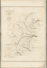
Map of Ireland, to accompany …
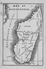
Map of Madagascar
m
Atlas géologique
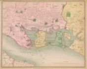
Portsmouth
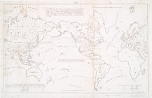
A chart of the world : exhibi…
Histoire de la catographie de…
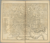
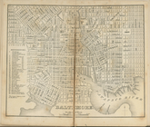
Baltimore.
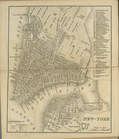
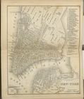
New-York.
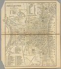
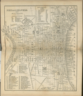
Philadelphia and environs.
Baltimore.
Philadelphia and environs.
New-York.
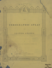
The cerographic atlas of the …
verso title page
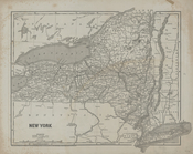
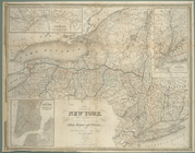
New York
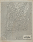
City of New York, 1843.
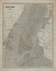
New York and vicinity.
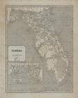
Florida.
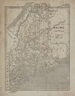
Maine.
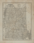
Vermont and New Hampshire.
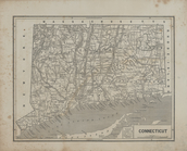
Connecticut.
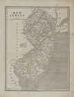
New Jersey.
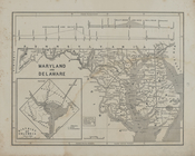
Maryland and Delaware.
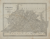
Virginia
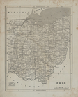
Ohio.
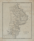
Iowa.
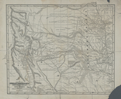
Map of the Indian Territory, …
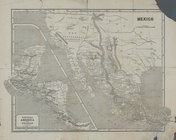
Central America and Yucatan (…
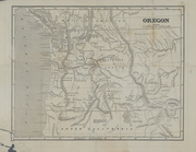
Oregon.
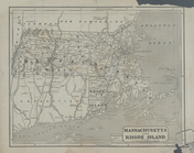
Massachusetts and Rhode Islan…
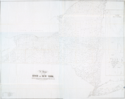
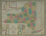
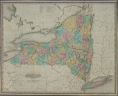
A map of the state of New Yor…
No. 1: [This map shows the po…
A map of the State of New Yor…
A map prepared for the report…
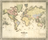
The world, on Mercator's proj…
Distance map of the state of …
m
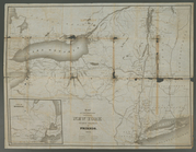
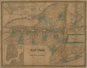
Map of New York exhibiting th…
Map of the meetings constitut…
Map of the state of New York …
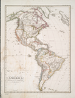
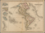
America
Map of the state of New York …
Map of the state of New York …
Map of the state of New York …
m
Walden Pond. A reduced plan. …
Carte de l'Amerique
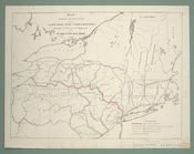
Map shewing the rail roads be…
Neueste Karte von New York : …
New York
New York
1
2
3
Previous
Next
1
2
3
Previous
Next