Click to visit the main New York Public Library Homepage
The New York Public Library
Digital Collections
About Digital Collections
Browse
Search only public domain materials
Items
Collections
Divisions
Home
Search
Browse
About
Search only public domain materials
Items
Collections
Divisions
Digital Collections
Using Images
Using Data
Search
Filtered search
Show filters
Hide filters
Show Only Public Domain
topic
History
3
Aerial views
1
Early works to 1800
1
Facsimiles
1
Fossils
1
More
Less
name
Hayward, George, approximately 1800-
2
Sarony & Co
2
Valentine, D. T. (David Thomas), 1801-1869
2
American Revolution (1775-1783)
1
Bliss, Luther, 1781-1854
1
More
Less
collection
x
Maps of New York City and State
place
x
United States
New York (State)
7
Brooklyn (New York, N.Y.)
2
Hudson River (N.Y. and N.J.)
2
Hudson River Valley (N.Y. and N.J.)
2
More
Less
genre
Maps
9
Facsimiles
2
Early maps
1
Geological maps
1
publisher
Geo. Hayward's Lith
1
George Hayward
1
J.H. Colton & Co
1
L. Bliss, Bookseller
1
Lith. of Endicott
1
More
Less
division
Map Division
9
type
x
cartographic
Date Range
to
9 results found
Filtering on:
x
Date
: 1841 - 1863
x
Place
: United States
x
Collection
: Maps of New York City and State
x
Type
: cartographic
For more collection details, visit the
Maps of New York City and State collection page
.
Sort by:
Title
Date created
Date digitized
Sequence
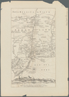
Map of the port & vicinity of…
Battle of Long Island: from S…
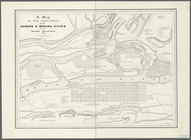
Map of Brooklyn at the time o…
Operations on the Hudson River
Map of New Netherland with a …
Map of New Netherland which w…
A map of the confluence of th…
Geology of the Genesee River
De Noord Rivier anders R. Man…