Click to visit the main New York Public Library Homepage
The New York Public Library
Digital Collections
About Digital Collections
Browse
Search only public domain materials
Items
Collections
Divisions
Home
Search
Browse
About
Search only public domain materials
Items
Collections
Divisions
Digital Collections
Using Images
Using Data
Search
Filtered search
Show filters
Hide filters
Show Only Public Domain
topic
Indians of North America
2
Railroads
2
Atlases
1
Boundaries
1
Canals
1
More
Less
name
Breese, Samuel, 1802-1873
18
Morse, Sidney E. (Sidney Edwards), 1794-1871
18
Mitchell, S. Augustus (Samuel Augustus), 1792-1868
2
Abert, John James, 1788-1863
1
Barritt, William, approximately 1822-
1
More
Less
collection
Atlases of the United States
18
Maps of North America
11
Maps of New York City and State
2
place
x
United States
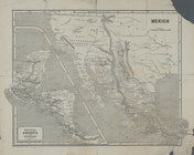
Mexico
4
Texas
4
Connecticut
2
Hudson River Valley (N.Y. and N.J.)
2
More
Less
genre
Maps
31
Geological maps
1
publisher
S. E. Morse & co.,
18
s.n
2
E.F. Woodward
1
Harper & Brothers
1
In commission bei Wimmer, Schmidt & Leo
1
More
Less
division
x
Map Division
type
cartographic
30
text
1
Date Range
to
31 results found
Filtering on:
x
Date
: 1844 - 1847
x
Division
: Map Division
x
Place
: United States
Sort by:
Title
Date created
Date digitized
Sequence
Map of Texas and the countrie…
Map of Massachusetts, Connect…
Geology of the Genesee River
Map of the western and middle…
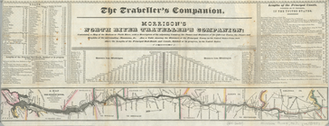
Morrison's North River travel…
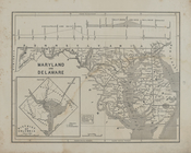
Maryland and Delaware.
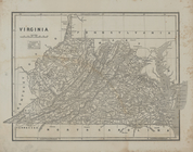
Virginia
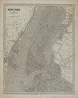
New York and vicinity.
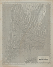
City of New York, 1843.
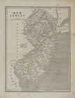
New Jersey.
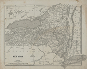
New York
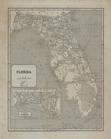
Florida.
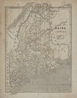
Maine.
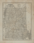
Vermont and New Hampshire.
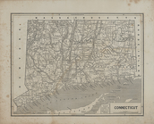
Connecticut.
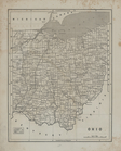
Ohio.
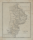
Iowa.
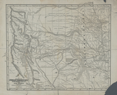
Map of the Indian Territory, …
Central America and Yucatan (…
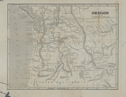
Oregon.
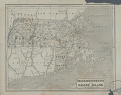
Massachusetts and Rhode Islan…
verso title page
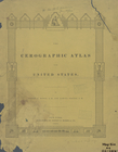
The cerographic atlas of the …
Ornamental map of the United …
Map of the United States and …
Map of the Vermont Central Ra…
Ensign's Travellers' guide an…
Map of the United States and …
Karte der katholischen Dioece…
The United States & the relat…
No. 15 map of Oregon and Uppe…
End of results
|
Top