Click to visit the main New York Public Library Homepage
The New York Public Library
Digital Collections
About Digital Collections
Browse
Search only public domain materials
Items
Collections
Divisions
Home
Search
Browse
About
Search only public domain materials
Items
Collections
Divisions
Digital Collections
Using Images
Using Data
Search
Filtered search
Show filters
Hide filters
Show Only Public Domain
topic
x
Real property
Fire insurance
105
Landowners
69
Administrative and political divisions
22
Cities and towns
12
More
Less
name
Perris, William
260
Perris & Browne
130
Beers, S. N
51
Beers, D. G. (Daniel G.)
42
Smith, Robert Pearsall, 1827-1898
16
More
Less
collection
Atlases of New York City
258
Maps of New York City and State
113
Atlases of the United States
89
place
x
New York (State)
New York
299
Manhattan (New York, N.Y.)
264
Saint Lawrence County
50
Saint Lawrence County (N.Y.)
48
More
Less
genre
Maps
459
Atlases
89
Cadastral maps
59
Index maps
13
Title pages
13
More
Less
publisher
Perris & Browne
124
William Perris
105
C.K. Stone
42
Lith. by Korff Brothers
23
William Perris, Civil Engineer
23
More
Less
division
Map Division
330
type
cartographic
455
text
14
still image
6
Date Range
to
460 results found
Filtering on:
x
Date
: 1844 - 1865
x
Place
: New York (State)
x
Topic
: Real property
Sort by:
Title
Date created
Date digitized
Sequence
Property in the towns of Cast…
Map of property in the 19th w…
m
Topographical map of New York…
m
Map of the City of Brooklyn a…
m
Peremptory sale of a suburban…
Flushing
m
Map of the southern part of W…
m
Map of Ulster County, New York
m
Map of Washington County, New…
Map of the port & vicinity of…
m
Map of Clinton Co., New York:…
m
Map of Dutchess Co., New York…
m
Map of Kings and part of Quee…
m
Map of Albany County, New Yor…
Map of the "Hunter Fly Farm" …
A map of part of the land in …
Map of the head waters of the…
A map of a tract of land in t…
A new map of the city of Buff…
A plan of the Manor of Philip…
Town & village of Seneca Fall…
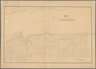
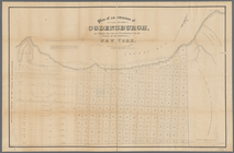
Map of Ogdensburgh
Plan of an extension of the v…
Plan of the easterly part of …
Town of Greenburgh: Westchest…
Atherton, St. Lawrence County…
Map of Richland, Oswego Co. N…
Topographical map of New York…
m
Map of Suffolk Co., L.I., New…
m
Map of Tioga County, New York…
Town & village of Ovid, Senec…
Map of the county of Herkimer
Country-seat of Danl. P. Barn…
m
Village of Buffalo
m
Map of the city of Albany: wi…
m
Map of the village & town of …
m
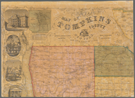
Map of Tompkins County, New Y…
m
Map of Ulster County, New York
Map of Chenango County, New Y…
m
Map of Rensselaer Co., New Yo…
m
Gillette's map of Oneida Co.,…
m
Map of Delaware Co., New York
m
Map of Orange and Rockland Co…
Map of French & English grant…
Map of part of the village of…
m
Map of Oswego, Oswego Co., N.…
m
Map of the town of Morrisania…
m
Map of Geneva, Ontario Co., N…
Map of the town of Niagara
Plan of the city of Albany ab…
1
2
Previous
Next
1
2
Previous
Next