Click to visit the main New York Public Library Homepage
The New York Public Library
Digital Collections
About Digital Collections
Browse
Search only public domain materials
Items
Collections
Divisions
Home
Search
Browse
About
Search only public domain materials
Items
Collections
Divisions
Digital Collections
Using Images
Using Data
Search
Filtered search
Show filters
Hide filters
Show Only Public Domain
topic
Railroads
4
Boundaries
2
Canals
2
Indians of North America
2
Administrative and political divisions
1
More
Less
name
Friend & Aub
2
Gavit, John E., 1817-1874
2
Graham, J. D. (James Duncan), 1799-1865
2
Johnson, Guy, approximately 1740-1788
2
Tanner, Henry Schenck, 1786-1858
2
More
Less
collection
Maps of North America
12
Maps of New York City and State
1
place
x
Pennsylvania
Delaware
4
Maryland
4
New Jersey
3
New York (State)
2
More
Less
genre
x
Maps
Early maps
2
Early works to 1800
2
Facsimiles
2
publisher
publisher not identified
5
Commission on Boundary Lines between Delaware, Maryland, and Pennsylvania?,
1
H.S. Tanner
1
John E. Gavit
1
Lindsay & Blakiston
1
More
Less
division
Map Division
13
type
cartographic
13
Date Range
to
13 results found
Filtering on:
x
Date
: 1845 - 1852
x
Genre
: Maps
x
Place
: Pennsylvania
Sort by:
Title
Date created
Date digitized
Sequence
Map of the frontiers of the n…
To the citizens of Philadelph…
Plan of the city of Philadelp…
Plan of a mineral estate situ…
The boundary lines between th…
A new county map of the state…
A map of part of the Province…
m
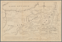
To his excellency William Try…
Map showing a portion of the …
A map of the canals & rail ro…
A map of the canals & rail ro…
m
Map of Pennsylvania
Map of the first and second a…
End of results
|
Top