Click to visit the main New York Public Library Homepage
The New York Public Library
Digital Collections
About Digital Collections
Browse
Search only public domain materials
Items
Collections
Divisions
Home
Search
Browse
About
Search only public domain materials
Items
Collections
Divisions
Digital Collections
Using Images
Using Data
Search
Filtered search
Show filters
Hide filters
Show Only Public Domain
topic
Administrative and political divisions
16
Real property
15
Railroads
14
Nautical charts
10
Canals
8
More
Less
name
Tanner, Henry Schenck, 1786-1858
8
United States Coast Survey
8
Bache, A. D. (Alexander Dallas), 1806-1867
7
Mitchell, S. Augustus (Samuel Augustus), 1792-1868
7
Bache, George M
4
More
Less
collection
Maps of North America
61
Maps of New York City and State
34
Africa
1
Atlases, gazetteers, guidebooks and other books
1
Henry David Thoreau collection
1
More
Less
place
New York (State)
20
New York (N.Y.)
16
New York
11
Massachusetts
10
Brooklyn (New York, N.Y.)
9
More
Less
genre
x
Maps
Cadastral maps
6
Nautical charts
4
Manuscript maps
2
Drawings
1
More
Less
publisher
publisher not identified
10
S. Augustus Mitchell
5
Surveyor General's Office
3
U.S. Coast Survey
3
s.n
3
More
Less
division
Map Division
96
Schomburg Manuscripts, Archives and Rare Books Division
2
Berg Collection
1
Schomburg Jean Blackwell Hutson Research and Reference Division
1
Wallach Division: Picture Collection
1
type
cartographic
99
text
6
still image
1
Date Range
to
101 results found
Filtering on:
x
Date
: 1846 - 1848
x
Genre
: Maps
Sort by:
Title
Date created
Date digitized
Sequence
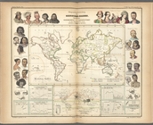
Geographische Verbreitung der…
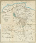
Carte des Parties Centrales D…
H Diagram of the state of Mis…
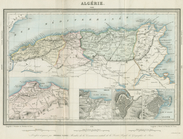
Algerie
Plat of a survey of land "for…
Chicago : correctly copied fr…
A sketch of the public survey…
Diagram of part of the State …
Sketch of the claims to land …
Township no. 74 N. range no.…
Private claims at Michilimack…
Map of the state of Georgia :…
A new sectional map of the st…
Sketch of the public surveys …
m
Map of Oregon and upper Calif…
Map of the canals and rail ro…
Sketch of the battle ground a…
Sketch of the battle ground a…
Chart of Green Bay
Map showing the route pursued…
Positions of the upper and lo…
Topographical sketch of the g…
Map of the city of Chicago
G, diagram of the state of Il…
New sectional map of the stat…
The state of Florida
A plat exhibiting the state o…
Massachusetts and Rhode Island
Harbors of Sheffield Island a…
Plan of an extension of the v…
The Harbor of New Bedford
Map of the southern states to…
A map of the City of Worcester
New Hampshire & Vermont
A New map of Maine
Preliminary sketch showing th…
The harbor of Holmes' Hole: t…
Van Der Donck's map of New Ne…
New map of Massachusetts
Geer's map of the city of Har…
Connecticut
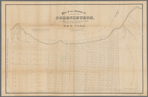
Plan of Groton Cemetery
m
Map of Essex & part of Middle…
The principal parts of Norwal…
The south part of New-England…
Map of the head waters of the…
Map of Massachusetts, Connect…
Sketch of the states of Massa…
Hydrographic map of the count…
Onondaga County & adjacent te…