Click to visit the main New York Public Library Homepage
The New York Public Library
Digital Collections
About Digital Collections
Browse
Search only public domain materials
Items
Collections
Divisions
Home
Search
Browse
About
Search only public domain materials
Items
Collections
Divisions
Digital Collections
Using Images
Using Data
Search
Filtered search
Show filters
Hide filters
Show Only Public Domain
topic
Historic sites
50
Antiquities
40
Real property
31
Administrative and political divisions
23
Railroads
20
More
Less
name
Lepsius, Richard, 1810-1884
39
Monecke, C
21
Erbkam, Georg Gustav, 1811-1876
20
Pease, Richard H., 1813-1869
12
Atwood, John M., approximately 1818-
11
More
Less
collection
Maps of North America
121
Maps of New York City and State
76
Cigarette cards
51
Denkmaeler aus Aegypten und Aethiopien nach den Zeichnungen der von seiner Majestat dem Koenige von Preussen Friedrich Wilhelm IV nach diesen Landern gesendeten und in den Jahren 1842-1845 ausgefuhrten wissenschaftlichen Expedition ..
39
Histoire complète des voyages et découvertes en Afrique, depuis les siècles les plus reculés jusqu'a nos jours
7
More
Less
place
Great Britain
51
New York (State)
46
Egypt
40
New York (N.Y.)
33
United States
23
More
Less
genre
Maps
270
Advertisements
51
Advertising cards
51
Cards
51
Cigarette cards
51
More
Less
publisher
Nicolaische Buchhandlung
39
publisher not identified
35
s.n
8
A. Bertrand
7
Surveyor General's Office
7
More
Less
division
Map Division
205
George Arents Collection
51
General Research Division
47
Milstein Division
3
Dorot Jewish Division
2
More
Less
type
x
cartographic
still image
54
text
51
Date Range
to
313 results found
Filtering on:
x
Date
: 1848 - 1850
x
Type
: cartographic
Sort by:
Title
Date created
Date digitized
Sequence
Geographische Verbreitung der…
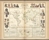
Ethnographic map of the world…
Plan of the town of Brooklyn …
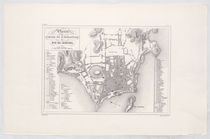
Planta da Cidade de Sebastiao…
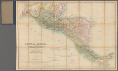
Map of Central America includ…
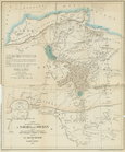
Carte des Parties Centrales D…
Map of the Battery in 1786 an…
General views, W, 39th St.
Map of 7 Washington Sq.
Map of the Great Salt Lake an…
H Diagram of the state of Mis…
Map of the frontiers of the n…
Map of the territory of Minne…
A sketch of the public survey…
Geological map of the distric…
Sketch of the public surveys …
To the citizens of Philadelph…
Map of the mouth of St. Clair…
Diagram of the state of Misso…
Geological map of Keweenaw Po…
Diagram of part of the State …
Geological map of Isle Royale…
Section and diagram illustrat…
Diagram of the state of Michi…
Map of the northern peninsula…
Geological map of the distric…
Geological map of Isle Royale…
Map of the tertiary of Essex …
Geological map of the Lake Su…
Map of Chicago and vicinity
Sketch of the public surveys …
A sketch of the public survey…
A new map of the state of Ohio
m
Map of Oregon and upper Calif…
Geological reconnaissances in…
Alexander von Humboldt's Syst…
A correct map of the Bay of S…
Sketch of the route of Capt. …
Positions of the upper and lo…
Map of the city of San Franci…
Topographical sketch of the g…
Topographical sketch of the s…
The Sacramento Valley from th…
Plan of Ohio City in the stat…
Map of the states of Missouri…
Map of lands belonging to Jam…
Map of the "Hunter Fly Farm" …
A map of Maryland and Virgini…
Map of Indiana
Indiana, 1820
1
2
Previous
Next
1
2
Previous
Next