Click to visit the main New York Public Library Homepage
The New York Public Library
Digital Collections
About Digital Collections
Browse
Search only public domain materials
Items
Collections
Divisions
Home
Search
Browse
About
Search only public domain materials
Items
Collections
Divisions
Digital Collections
Using Images
Using Data
Search
Filtered search
Show filters
Hide filters
Show Only Public Domain
topic
Real property
5054
Fire insurance
3271
Cities & towns
3085
Administrative and political divisions
505
Railroads
435
More
Less
name
Sanborn Map Company
3085
Beers, F. W. (Frederick W.)
534
Perris, William
308
United States Coast Survey
251
Everts, Ensign & Everts
231
More
Less
collection
Atlases of New York City
3956
Atlases of the United States
1898
Maps of North America
1716
Maps of New York City and State
844
Atlases, gazetteers, guidebooks and other books
80
More
Less
place
New York (State)
5375
New York
676
Manhattan (New York, N.Y.)
403
Brooklyn (New York, N.Y.)
367
New York (N.Y.)
333
More
Less
genre
Maps
8621
Atlases
1866
Cadastral maps
299
Nautical charts
182
Prints
177
More
Less
publisher
Sanborn Map Company
3085
publisher not identified
246
F. W. Beers & Co
148
William Perris
142
U.S. Coast Survey
130
More
Less
division
Map Division
8386
General Research Division
80
George Arents Collection
51
Rare Book Division
31
Schomburg Jean Blackwell Hutson Research and Reference Division
16
More
Less
type
x
cartographic
still image
143
text
124
Date Range
to
8,751 results found
Filtering on:
x
Date
: 1848 - 1884
x
Type
: cartographic
Sort by:
Title
Date created
Date digitized
Sequence
m
Nuevo mapa topográfico de la …
Plan of the Central Park, Cit…
Map of Camp Chase. Drawn on a…
Map illustrating the operatio…
Saratoga Springs [Township]
Schuylerville Business Direct…
Saratoga [Township]
Stillwater [Township]
References; Waterford [Villag…
Waterford [Township]
Beechers Hollow [Village]; Be…
Wilton [Township]
Map of Saratoga County
Residence of James Carrigan, …
Ballston [Township]
Ballston Spa Business Directo…
Charlton [Township]
Grangerville [Village]; Grang…
Clifton Park [Township]
Corinth [Township]; Palmer Fa…
Clifton Park [Village]; Clift…
Day Corners Business Director…
Edinburgh [Township]
Crescent [Village]; Crescent …
Galway [Township]; Yorks Corn…
Greenfield [Township]; Pages …
Bloodville [Village]; Bloodvi…
Hadley [Township]; Hadley Bus…
Half Moon [Township]
Factory Village [Village]; Fa…
Malta [Township]
Burnt Hills [Village]; Burnt …
Milton [Township]
Moreau [Township]
Conklingville [Village]; Conk…
Northumberland [Township]
Providence [Township]; Hagedo…
References; Saratoga Springs …
Geographische Verbreitung der…
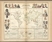
Ethnographic map of the world…
Das freie und das Sklaverei-G…
The Jeannette ; Lost In the I…
m
Mercator projection exhibitin…
m
Atlas géologique
Chart of Smith Sound Showing …
Map showing North Pole, [Map]
Port Foulke and Vicinity Nort…
m
Map of the city of Brooklyn, …
North polar chart: track of t…
The countries round the North…
1
2
3
4
5
6
7
8
9
10
…
35
36
Previous
Next
1
2
3
4
5
6
7
8
9
10
…
35
36
Previous
Next