Click to visit the main New York Public Library Homepage
The New York Public Library
Digital Collections
About Digital Collections
Browse
Search only public domain materials
Items
Collections
Divisions
Home
Search
Browse
About
Search only public domain materials
Items
Collections
Divisions
Digital Collections
Using Images
Using Data
Search
Filtered search
Show filters
Hide filters
Show Only Public Domain
topic
Coasts
2
Description and travel
2
Nautical charts
2
Antiquities
1
Geophysics
1
More
Less
name
Bache, A. D. (Alexander Dallas), 1806-1867
2
Brockedon, William (1787-1854)
2
Croly, George (1780-1860)
2
Haghe, Louis (1806-1885 )
2
McCoy, G
2
More
Less
collection
Maps of North America
3
The Holy Land, Syria, Idumea, Arabia, Egypt and Nubia: From drawings made on the spot
2
Egypt & Nubia
1
Voyages de la Commission scientifique du Nord en Scandinavie, en Laponie, au Spitzberg et aux Feröe: pendant les années 1838, 1839 et 1840, sur la corvette la Recherche, commandée par M. Fabvre
1
place
Middle East
2
Pacific Coast
2
Arctic regions
1
California
1
Egypt
1
More
Less
genre
x
Illustrations
Prints
4
Maps
3
Atlases
1
Cadastral maps
1
More
Less
publisher
F.G. Moon,
2
Arthus Bertrand
1
F.G. Moon
1
Henry Hart
1
The Survey
1
More
Less
division
Map Division
3
Dorot Jewish Division
2
General Research Division
2
type
x
cartographic
still image
4
text
1
Date Range
to
7 results found
Filtering on:
x
Date
: 1849 - 1855
x
Genre
: Illustrations
x
Type
: cartographic
Sort by:
Title
Date created
Date digitized
Sequence
m
Atlas géologique
m
City of Toledo, Lucas Co., Oh…
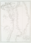
Reconnaissance of the western…
Reconnaissance of the western…
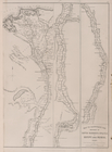
Map to illustrate the sketche…
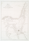
Map to Illustrate the Route o…
Map to illustrate the sketche…