Click to visit the main New York Public Library Homepage
The New York Public Library
Digital Collections
About Digital Collections
Browse
Search only public domain materials
Items
Collections
Divisions
Home
Search
Browse
About
Search only public domain materials
Items
Collections
Divisions
Digital Collections
Using Images
Using Data
Search
Filtered search
Show filters
Hide filters
Show Only Public Domain
topic
Real property
21
Landowners
15
Railroads
2
Administrative and political divisions
1
Buildings
1
More
Less
name
Newton, W. H
2
Pease, Richard H., 1813-1869
2
Walling, Henry Francis, 1825-1888
2
Bingham, Reuben H
1
Clark, Thos
1
More
Less
collection
Maps of North America
13
Maps of New York City and State
9
place
New York (State)
9
Massachusetts
4
Superior (Wis.)
2
Superior, Lake
2
Wisconsin
2
More
Less
genre
x
Cadastral maps
Maps
22
Wall maps
2
Illustrations
1
publisher
x
publisher not identified
Lith. by Berggoetz & Co
1
division
Map Division
22
type
x
cartographic
still image
1
Date Range
to
22 results found
Filtering on:
x
Date
: 1849 - 1859
x
Genre
: Cadastral maps
x
Publisher
: publisher not identified
x
Type
: cartographic
Sort by:
Title
Date created
Date digitized
Sequence
Map of the mouth of St. Clair…
Map of the city of Saint Paul…
Map of the town of Huron, Mic…
Superior, Douglass County, Wi…
m
Map of Albany County, New Yor…
Map of lands belonging to Jam…
Map of the town of Fairhaven,…
Map of the city of Davenport …
m
Superior, Douglas County, Wis…
Map of the town of Raynham, B…
Map of Venango County, Pennsy…
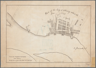
City of Covington
A plan of the Manor of Philip…
Plan of the easterly part of …
Atherton, St. Lawrence County…
Plan of Public Garden: showin…
Plan of house lots in South F…
m
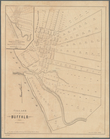
Village of Buffalo
Map of part of Orange County,…
Plan of the city of Albany ab…
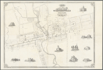
Map of the village of William…
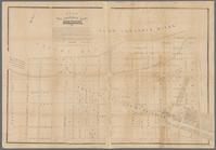
Map of the City of New York: …
End of results
|
Top