Click to visit the main New York Public Library Homepage
The New York Public Library
Digital Collections
About Digital Collections
Browse
Search only public domain materials
Items
Collections
Divisions
Home
Search
Browse
About
Search only public domain materials
Items
Collections
Divisions
Digital Collections
Using Images
Using Data
Search
Filtered search
Show filters
Hide filters
Show Only Public Domain
topic
Historic sites
50
Landowners
17
Real property
17
Explorations and surveys
9
Pacific railroads
9
More
Less
name
United States. War Department. Office of P.R.R. Surveys
10
Blake, William P. (William Phipps), 1826-1910
7
Williamson, R. S. (Robert Stockton), 1824-1882
7
United States Coast Survey
5
Walling, Henry Francis, 1825-1888
5
More
Less
collection
Cigarette cards
51
Maps of North America
31
Maps of New York City and State
8
Wallach Division Picture Collection
5
Sobranie kart i risunkov k izledovaniam o drevnostiakh IUzhnoi Rossii i beregov Chernago Moria
2
More
Less
place
Great Britain
50
California
11
New York (State)
10
United States
7
Maine
4
More
Less
genre
x
Maps
Advertisements
51
Advertising cards
51
Cards
51
Cigarette cards
51
More
Less
publisher
War Dept., U.S. Pacific Rail Road Explorations & Surveys
8
Lee & Marsh
3
U.S. Coast Survey
3
publisher not identified
2
A.R.Z. Dawson
1
More
Less
division
George Arents Collection
51
Map Division
39
Wallach Division: Picture Collection
6
Rare Book Division
2
type
x
still image
cartographic
89
text
52
Date Range
to
98 results found
Filtering on:
x
Date
: 1849 - 1859
x
Genre
: Maps
x
Type
: still image
Sort by:
Title
Date created
Date digitized
Sequence
m
Topographical map of the coun…
m
Map of Clinton Co., New York:…
Barometric profile of the rou…
m
City of Toledo, Lucas Co., Oh…
m
Map of Dutchess Co., New York…
Geological plan & section fro…
Geological section of the Coa…
Geological section along the …
Geological section of the Sie…
Geological section from the C…
Geological section of the Ber…
Reconnaissance of the western…
Reconnaissance of Smith's or …
Reconnaissance of Trinidad Ba…
Map and profile of the Tejon …
Map of Clinton County, Ohio
Map and profile of the Cañada…
Reconnaissance of the western…
m
Map of Trumbull County, Ohio
Map of Perry County, Ohio
Map of the city of San Franci…
Geological sections of the Be…
Sections of the Colorado Dese…
Reconnaissance of the S.E. en…
This plan of the city of Balt…
Map of the city of Davenport …
Map of the State of Georgia
Map of Bennington County, Ver…
m
Stony Point and Verplanck's P…
Leavitt's map with views of t…
Map of Waldo County, Maine: f…
m
A topographical map of Lincol…
m
Map of the county of Berkshir…
Town & village of Ovid, Senec…
m
A topographical map of Lincol…
m
Map of Ontario County, New Yo…
m
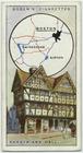
Shodfriars Hall.
m
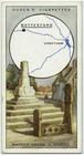
Market cross & stocks, Bottes…
m
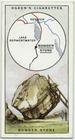
Bowderstone.
m
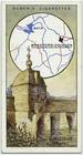
Old bridge & chapel.
m
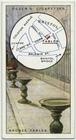
Bronze tables.
m
Market cross.
m
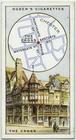
The cross.
m
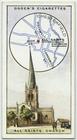
All Saints Church.
m
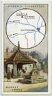
Wool market.
m
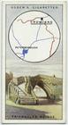
Triangular bridge.
m
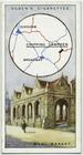
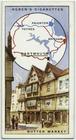
Butter market.
m
Yarn market.
m
Buttress, All Saints Church.
m
Old tolbooth.